Gau-Algesheim geodata
Gau-Algesheim (Rheinland-Pfalz) is a populated place; located in Germany in Europe/Berlin (GMT+2) time zone. With population of 6,553 people, there are 2294 cities with bigger population in this country. Compared to other cities in Germany, 64.9% of cities are located further ↑North; 76.8% of cities are located further →East and 67.1% of cities have higher elevation than Gau-Algesheim. Note1
Administrative division(s):
- Level 1: Rheinland-Pfalz
- Level 3: Landkreis Mainz-Bingen
- Level 4: Gau-Algesheim


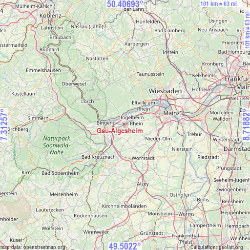
Gau-Algesheim GPS coordinates[2]
49° 57' 24.084" North, 8° 0' 56.484" East
| Map corner | latitude | longitude |
|---|---|---|
| Upper-left | 50.40693°, | 7.31257° |
| Center: | 49.95669°, | 8.01569° |
| Lower-right: | 49.5022°, | 8.71882° |
| Map W x H: | 100.6×100.6 km | = 62.5×62.5mi |
| max Lat: | 55.01917° ⇑64.9% North |
| Gau-Algesheim: | 49.95669° |
| min Lat: | ⇓35.1% South 47.40724° |
| min Long | Gau-Algesheim | max Long |
| 5.92978° | 8.01569° | 14.98853° |
| W 23.2%⇐ | ⇒76.8% E |
Elevation
Elevation of Gau-Algesheim is 107 m = 351 ft, and this is 142.1 m = 466 ft below average elevation for this country.
| Max E: |
1256 m = 4121 ft | 67.1% |
| Avg. | 249.1 m = 817 ft | |
| Gau-Algesheim | 107 m = 351 ft | |
Min E: |
-5 m = -16 ft | 32.9% |
See also: Germany elevation on elevation.city.
Geographical zone
Gau-Algesheim is located in North temperate zone (between Tropic of Cancer and the Arctic Circle). Distance of this North polar circle is 1846.5 km =1147.4 mi to North.| Distance of | km | miles | from Gau-Algesheim |
|---|---|---|---|
| North Pole | 4452.4 | 2766.6 | to North |
| Arctic Circle | 1846.5 | 1147.4 | to North |
| Tropic Cancer | 2948.7 | 1832.2 | to South |
| Equator | 5554.7 | 3451.5 | to South |


Nearby cities:
15 places around Gau-Algesheim: (largest is in red/bold)
• Appenheim
3.2 km =2 mi,  156°
156°
• Aspisheim
6.7 km =4.2 mi,  200°
200°
• Bingen am Rhein
8.4 km =5.2 mi,  277°
277°
• Bubenheim
6 km =3.7 mi,  130°
130°
• Engelstadt
6.8 km =4.2 mi,  148°
148°
• Geisenheim
4.6 km =2.9 mi,  312°
312°
• Horrweiler
7.2 km =4.5 mi,  209°
209°
• Ingelheim am Rhein
3.5 km =2.2 mi,  63°
63°
• Nieder-Hilbersheim
5.2 km =3.2 mi, 158°
• Nieder-Ingelheim
4.7 km =2.9 mi, 60°
• Ober-Hilbersheim
6.4 km =4 mi,  171°
171°
• Ockenheim
3.5 km =2.2 mi,  245°
245°
• Rüdesheim am Rhein
7 km =4.3 mi,  290°
290°
• Schwabenheim
6.5 km =4 mi,  118°
118°
• Wackernheim
7.5 km =4.7 mi,  74°
74°
Sources, notices
• [Note1] Compared only with cities in Germany existing in our database
• [Src1] Map data: © OpenStreetMap contributors (CC-BY-SA)
• [Src2] Other city data from geonames.org with taken over terms of usage.
• [Src3] Geographical zone / Annual Mean Temperature by Robert A. Rohde @ Wikipedia
