Ochtendung geodata
Ochtendung (Rheinland-Pfalz) is a seat of a fourth-order administrative division; located in Germany in Europe/Berlin (GMT+2) time zone. With population of 5,207 people, there are 2737 cities with bigger population in this country. Compared to other cities in Germany, 55.7% of cities are located further ↑North; 88.8% of cities are located further →East and 55.9% of cities have higher elevation than Ochtendung. Note1
Administrative division(s):
- Level 1: Rheinland-Pfalz
- Level 3: Landkreis Mayen-Koblenz
- Level 4: Ochtendung


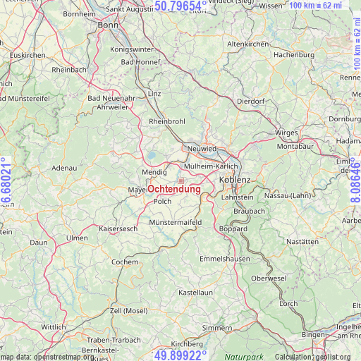
Ochtendung GPS coordinates[2]
50° 21' 0" North, 7° 22' 59.988" East
| Map corner | latitude | longitude |
|---|---|---|
| Upper-left | 50.79654°, | 6.68021° |
| Center: | 50.35°, | 7.38333° |
| Lower-right: | 49.89922°, | 8.08646° |
| Map W x H: | 99.8×99.8 km | = 62×62mi |
| max Lat: | 55.01917° ⇑55.7% North |
| Ochtendung: | 50.35° |
| min Lat: | ⇓44.3% South 47.40724° |
| min Long | Ochtendung | max Long |
| 5.92978° | 7.38333° | 14.98853° |
| W 11.2%⇐ | ⇒88.8% E |
Elevation
Elevation of Ochtendung is 182 m = 597 ft, and this is 67.1 m = 220 ft below average elevation for this country.
| Max E: |
1256 m = 4121 ft | 55.9% |
| Avg. | 249.1 m = 817 ft | |
| Ochtendung | 182 m = 597 ft | |
Min E: |
-5 m = -16 ft | 44.1% |
See also: Germany elevation on elevation.city.
Geographical zone
Ochtendung is located in North temperate zone (between Tropic of Cancer and the Arctic Circle). Distance of this North polar circle is 1802.8 km =1120.2 mi to North.| Distance of | km | miles | from Ochtendung |
|---|---|---|---|
| North Pole | 4408.7 | 2739.4 | to North |
| Arctic Circle | 1802.8 | 1120.2 | to North |
| Tropic Cancer | 2992.5 | 1859.5 | to South |
| Equator | 5598.4 | 3478.7 | to South |


Nearby cities:
15 places around Ochtendung: (largest is in red/bold)
• Bassenheim
5.5 km =3.4 mi,  80°
80°
• Dieblich
7.5 km =4.7 mi,  122°
122°
• Kerben
3.9 km =2.4 mi,  197°
197°
• Kobern-Gondorf
7.4 km =4.6 mi,  135°
135°
• Kretz
5.3 km =3.3 mi,  343°
343°
• Kruft
5.1 km =3.2 mi,  316°
316°
• Lonnig
4.7 km =2.9 mi,  160°
160°
• Mendig
7.3 km =4.5 mi,  284°
284°
• Plaidt
4.8 km =3 mi,  7°
7°
• Polch
7.5 km =4.7 mi,  221°
221°
• Rüber
5.7 km =3.5 mi,  192°
192°
• Saffig
4.4 km =2.7 mi,  32°
32°
• Trimbs
7 km =4.3 mi,  237°
237°
• Welling
5.1 km =3.2 mi,  248°
248°
• Wolken
6.2 km =3.9 mi,  107°
107°
Sources, notices
• [Note1] Compared only with cities in Germany existing in our database
• [Src1] Map data: © OpenStreetMap contributors (CC-BY-SA)
• [Src2] Other city data from geonames.org with taken over terms of usage.
• [Src3] Geographical zone / Annual Mean Temperature by Robert A. Rohde @ Wikipedia
