Saffig geodata
Saffig (Rheinland-Pfalz) is a seat of a fourth-order administrative division; located in Germany in Europe/Berlin (GMT+2) time zone. With population of 2,184 people, there are 4829 cities with bigger population in this country. Compared to other cities in Germany, 55% of cities are located further ↑North; 88.4% of cities are located further →East and 67.6% of cities have higher elevation than Saffig. Note1
Administrative division(s):
- Level 1: Rheinland-Pfalz
- Level 3: Landkreis Mayen-Koblenz
- Level 4: Saffig


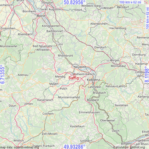
Saffig GPS coordinates[2]
50° 22' 59.988" North, 7° 25' 0.012" East
| Map corner | latitude | longitude |
|---|---|---|
| Upper-left | 50.82956°, | 6.71355° |
| Center: | 50.38333°, | 7.41667° |
| Lower-right: | 49.93286°, | 8.1198° |
| Map W x H: | 99.7×99.7 km | = 62×62mi |
| max Lat: | 55.01917° ⇑55% North |
| Saffig: | 50.38333° |
| min Lat: | ⇓45% South 47.40724° |
| min Long | Saffig | max Long |
| 5.92978° | 7.41667° | 14.98853° |
| W 11.6%⇐ | ⇒88.4% E |
Elevation
Elevation of Saffig is 104 m = 341 ft, and this is 145.1 m = 476 ft below average elevation for this country.
| Max E: |
1256 m = 4121 ft | 67.6% |
| Avg. | 249.1 m = 817 ft | |
| Saffig | 104 m = 341 ft | |
Min E: |
-5 m = -16 ft | 32.4% |
See also: Germany elevation on elevation.city.
Geographical zone
Saffig is located in North temperate zone (between Tropic of Cancer and the Arctic Circle). Distance of this North polar circle is 1799.1 km =1117.9 mi to North.| Distance of | km | miles | from Saffig |
|---|---|---|---|
| North Pole | 4405 | 2737.1 | to North |
| Arctic Circle | 1799.1 | 1117.9 | to North |
| Tropic Cancer | 2996.2 | 1861.8 | to South |
| Equator | 5602.1 | 3481 | to South |


Nearby cities:
15 places around Saffig: (largest is in red/bold)
• Andernach
5.4 km =3.4 mi,  350°
350°
• Bassenheim
4.1 km =2.5 mi,  132°
132°
• Kettig
4 km =2.5 mi,  62°
62°
• Kretz
4.1 km =2.5 mi,  289°
289°
• Kruft
5.9 km =3.7 mi,  270°
270°
• Leutesdorf
7.8 km =4.8 mi,  342°
342°
• Lonnig
8.2 km =5.1 mi,  185°
185°
• Mülheim-Kärlich
5.8 km =3.6 mi,  88°
88°
• Neuwied
6.8 km =4.2 mi,  34°
34°
• Nickenich
7.2 km =4.5 mi,  298°
298°
• Ochtendung
4.4 km =2.7 mi,  212°
212°
• Plaidt
2 km =1.2 mi, 301°
• Urmitz
8 km =5 mi, 62°
• Weißenthurm
4.5 km =2.8 mi, 32°
• Wolken
6.6 km =4.1 mi,  147°
147°
Sources, notices
• [Note1] Compared only with cities in Germany existing in our database
• [Src1] Map data: © OpenStreetMap contributors (CC-BY-SA)
• [Src2] Other city data from geonames.org with taken over terms of usage.
• [Src3] Geographical zone / Annual Mean Temperature by Robert A. Rohde @ Wikipedia
