Kobern-Gondorf geodata
Kobern-Gondorf (Rheinland-Pfalz) is a seat of a fourth-order administrative division; located in Germany in Europe/Berlin (GMT+2) time zone. With population of 3,306 people, there are 3752 cities with bigger population in this country. Compared to other cities in Germany, 56.7% of cities are located further ↑North; 87.8% of cities are located further →East and 61.9% of cities have higher elevation than Kobern-Gondorf. Note1
Administrative division(s):
- Level 1: Rheinland-Pfalz
- Level 3: Landkreis Mayen-Koblenz
- Level 4: Kobern-Gondorf


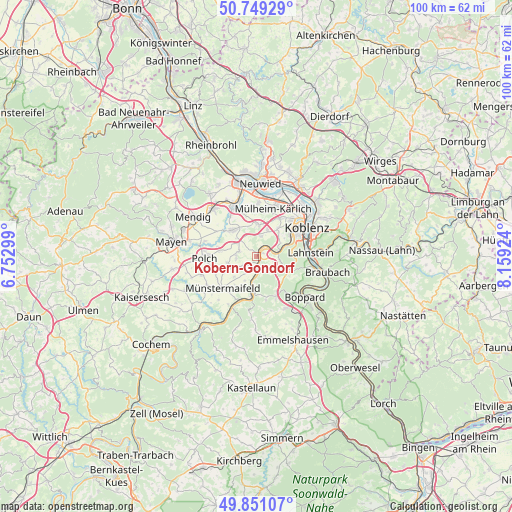
Kobern-Gondorf GPS coordinates[2]
50° 18' 8.28" North, 7° 27' 22.032" East
| Map corner | latitude | longitude |
|---|---|---|
| Upper-left | 50.74929°, | 6.75299° |
| Center: | 50.3023°, | 7.45612° |
| Lower-right: | 49.85107°, | 8.15924° |
| Map W x H: | 99.9×99.9 km | = 62.1×62.1mi |
| max Lat: | 55.01917° ⇑56.7% North |
| Kobern-Gondorf: | 50.3023° |
| min Lat: | ⇓43.3% South 47.40724° |
| min Long | Kobern-Gondorf | max Long |
| 5.92978° | 7.45612° | 14.98853° |
| W 12.2%⇐ | ⇒87.8% E |
Elevation
Elevation of Kobern-Gondorf is 139 m = 456 ft, and this is 110.1 m = 361 ft below average elevation for this country.
| Max E: |
1256 m = 4121 ft | 61.9% |
| Avg. | 249.1 m = 817 ft | |
| Kobern-Gondorf | 139 m = 456 ft | |
Min E: |
-5 m = -16 ft | 38.1% |
See also: Germany elevation on elevation.city.
Geographical zone
Kobern-Gondorf is located in North temperate zone (between Tropic of Cancer and the Arctic Circle). Distance of this North polar circle is 1808.1 km =1123.5 mi to North.| Distance of | km | miles | from Kobern-Gondorf |
|---|---|---|---|
| North Pole | 4414 | 2742.7 | to North |
| Arctic Circle | 1808.1 | 1123.5 | to North |
| Tropic Cancer | 2987.2 | 1856.2 | to South |
| Equator | 5593.1 | 3475.4 | to South |


Nearby cities:
15 places around Kobern-Gondorf: (largest is in red/bold)
• Alken
5.8 km =3.6 mi,  184°
184°
• Bassenheim
6.2 km =3.9 mi,  2°
2°
• Brodenbach
7.7 km =4.8 mi, 183°
• Dieblich
1.7 km =1.1 mi,  40°
40°
• Kalt
5.8 km =3.6 mi,  228°
228°
• Kerben
6.5 km =4 mi,  284°
284°
• Lehmen
2.2 km =1.4 mi,  191°
191°
• Lonnig
3.7 km =2.3 mi, 283°
• Niederfell
2.2 km =1.4 mi,  160°
160°
• Oberfell
4.7 km =2.9 mi, 189°
• Ochtendung
7.4 km =4.6 mi,  315°
315°
• Rüber
6.4 km =4 mi,  267°
267°
• Waldesch
7 km =4.3 mi,  107°
107°
• Winningen
4.6 km =2.9 mi,  69°
69°
• Wolken
3.5 km =2.2 mi,  12°
12°
Sources, notices
• [Note1] Compared only with cities in Germany existing in our database
• [Src1] Map data: © OpenStreetMap contributors (CC-BY-SA)
• [Src2] Other city data from geonames.org with taken over terms of usage.
• [Src3] Geographical zone / Annual Mean Temperature by Robert A. Rohde @ Wikipedia
