Obing geodata
Obing (Bavaria) is a seat of a fourth-order administrative division; located in Germany in Europe/Berlin (GMT+2) time zone. With population of 3,938 people, there are 3330 cities with bigger population in this country. Compared to other cities in Germany, 95.5% of cities are located further ↑North; 87% of cities are located further ←West and 93.6% of cities have lower elevation than Obing. Note1
Administrative division(s):
- Level 1: Bavaria
- Level 2: Upper Bavaria
- Level 3: Landkreis Traunstein
- Level 4: Obing


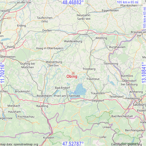
Obing GPS coordinates[2]
48° 0' 1.764" North, 12° 24' 19.008" East
| Map corner | latitude | longitude |
|---|---|---|
| Upper-left | 48.46882°, | 11.70216° |
| Center: | 48.00049°, | 12.40528° |
| Lower-right: | 47.52787°, | 13.10841° |
| Map W x H: | 104.6×104.6 km | = 65×65mi |
| max Lat: | 55.01917° ⇑95.5% North |
| Obing: | 48.00049° |
| min Lat: | ⇓4.5% South 47.40724° |
| min Long | Obing | max Long |
| 5.92978° | 12.40528° | 14.98853° |
| W 87%⇐ | ⇒13% E |
Elevation
Elevation of Obing is 567 m = 1860 ft, and this is 317.9 m = 1043 ft above average elevation for this country.
| Max E: |
1256 m = 4121 ft | 6.4% |
| Obing | 567 m 1860 ft | |
| Avg. | 249.1 m = 817 ft | |
Min E: |
-5 m = -16 ft | 93.6% |
See also: Germany elevation on elevation.city.
Geographical zone
Obing is located in North temperate zone (between Tropic of Cancer and the Arctic Circle). Distance of this North polar circle is 2064 km =1282.5 mi to North.| Distance of | km | miles | from Obing |
|---|---|---|---|
| North Pole | 4669.9 | 2901.7 | to North |
| Arctic Circle | 2064 | 1282.5 | to North |
| Tropic Cancer | 2731.2 | 1697.1 | to South |
| Equator | 5337.2 | 3316.4 | to South |


Nearby cities:
15 places around Obing: (largest is in red/bold)
• Amerang
7.3 km =4.5 mi,  262°
262°
• Babensham
13.8 km =8.6 mi,  311°
311°
• Bad Endorf
12.9 km =8 mi,  218°
218°
• Eggstätt
8.4 km =5.2 mi,  193°
193°
• Eiselfing
12.9 km =8 mi,  290°
290°
• Gstadt am Chiemsee
12.9 km =8 mi,  175°
175°
• Halfing
11.1 km =6.9 mi,  240°
240°
• Höslwang
7.7 km =4.8 mi,  227°
227°
• Kienberg
5.8 km =3.6 mi,  48°
48°
• Pittenhart
2.8 km =1.7 mi,  203°
203°
• Schnaitsee
7.9 km =4.9 mi,  338°
338°
• Schonstett
11.7 km =7.3 mi, 260°
• Schönberg
11.1 km =6.9 mi, 306°
• Seeon-Seebruck
5.9 km =3.7 mi,  129°
129°
• Trostberg an der Alz
11.8 km =7.3 mi,  74°
74°
Sources, notices
• [Note1] Compared only with cities in Germany existing in our database
• [Src1] Map data: © OpenStreetMap contributors (CC-BY-SA)
• [Src2] Other city data from geonames.org with taken over terms of usage.
• [Src3] Geographical zone / Annual Mean Temperature by Robert A. Rohde @ Wikipedia
