Eiselfing geodata
Eiselfing (Bavaria) is a seat of a fourth-order administrative division; located in Germany in Europe/Berlin (GMT+2) time zone. With population of 2,956 people, there are 4042 cities with bigger population in this country. Compared to other cities in Germany, 95% of cities are located further ↑North; 85.2% of cities are located further ←West and 86.6% of cities have lower elevation than Eiselfing. Note1
Administrative division(s):
- Level 1: Bavaria
- Level 2: Upper Bavaria
- Level 3: Landkreis Rosenheim
- Level 4: Eiselfing


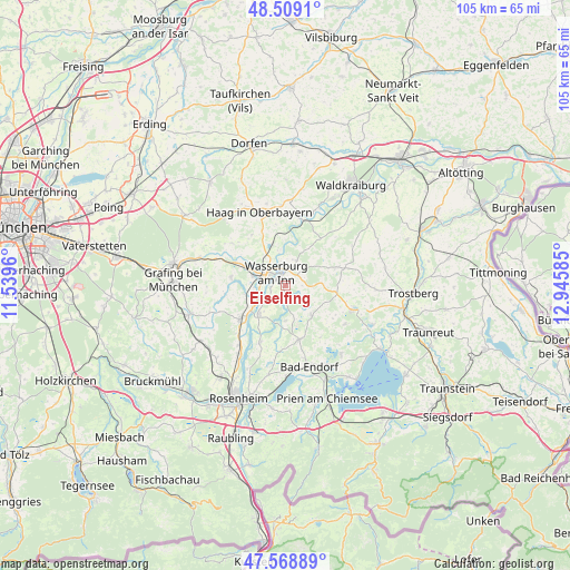
Eiselfing GPS coordinates[2]
48° 2' 28.104" North, 12° 14' 33.792" East
| Map corner | latitude | longitude |
|---|---|---|
| Upper-left | 48.5091°, | 11.5396° |
| Center: | 48.04114°, | 12.24272° |
| Lower-right: | 47.56889°, | 12.94585° |
| Map W x H: | 104.5×104.5 km | = 64.9×64.9mi |
| max Lat: | 55.01917° ⇑95% North |
| Eiselfing: | 48.04114° |
| min Lat: | ⇓5% South 47.40724° |
| min Long | Eiselfing | max Long |
| 5.92978° | 12.24272° | 14.98853° |
| W 85.2%⇐ | ⇒14.8% E |
Elevation
Elevation of Eiselfing is 482 m = 1581 ft, and this is 232.9 m = 764 ft above average elevation for this country.
| Max E: |
1256 m = 4121 ft | 13.4% |
| Eiselfing | 482 m 1581 ft | |
| Avg. | 249.1 m = 817 ft | |
Min E: |
-5 m = -16 ft | 86.6% |
See also: Germany elevation on elevation.city.
Geographical zone
Eiselfing is located in North temperate zone (between Tropic of Cancer and the Arctic Circle). Distance of this North polar circle is 2059.5 km =1279.7 mi to North.| Distance of | km | miles | from Eiselfing |
|---|---|---|---|
| North Pole | 4665.4 | 2898.9 | to North |
| Arctic Circle | 2059.5 | 1279.7 | to North |
| Tropic Cancer | 2735.8 | 1699.9 | to South |
| Equator | 5341.7 | 3319.2 | to South |


Nearby cities:
15 places around Eiselfing: (largest is in red/bold)
• Amerang
7.4 km =4.6 mi,  138°
138°
• Babensham
5 km =3.1 mi,  20°
20°
• Breitbrunn
6.6 km =4.1 mi,  271°
271°
• Edling
6 km =3.7 mi,  286°
286°
• Griesstätt
7.2 km =4.5 mi,  222°
222°
• Halfing
10.2 km =6.3 mi,  166°
166°
• Pfaffing
10 km =6.2 mi,  278°
278°
• Ramerberg
7.7 km =4.8 mi,  250°
250°
• Rechtmehring
10.1 km =6.3 mi,  326°
326°
• Schnaitsee
9.6 km =6 mi,  72°
72°
• Schonstett
6.5 km =4 mi,  175°
175°
• Schönberg
3.8 km =2.4 mi,  57°
57°
• Soyen
7.8 km =4.8 mi,  341°
341°
• Unterreit
10.8 km =6.7 mi,  38°
38°
• Wasserburg am Inn
1.9 km =1.2 mi,  311°
311°
Sources, notices
• [Note1] Compared only with cities in Germany existing in our database
• [Src1] Map data: © OpenStreetMap contributors (CC-BY-SA)
• [Src2] Other city data from geonames.org with taken over terms of usage.
• [Src3] Geographical zone / Annual Mean Temperature by Robert A. Rohde @ Wikipedia
