Obernburg am Main geodata
Obernburg am Main (Bavaria) is a populated place; located in Germany in Europe/Berlin (GMT+2) time zone. With population of 8,853 people, there are 1813 cities with bigger population in this country. Compared to other cities in Germany, 68% of cities are located further ↑North; 63.5% of cities are located further →East and 56.1% of cities have higher elevation than Obernburg am Main. Note1
Administrative division(s):
- Level 1: Bavaria
- Level 2: Regierungsbezirk Unterfranken
- Level 3: Landkreis Miltenberg
- Level 4: Obernburg a.Main


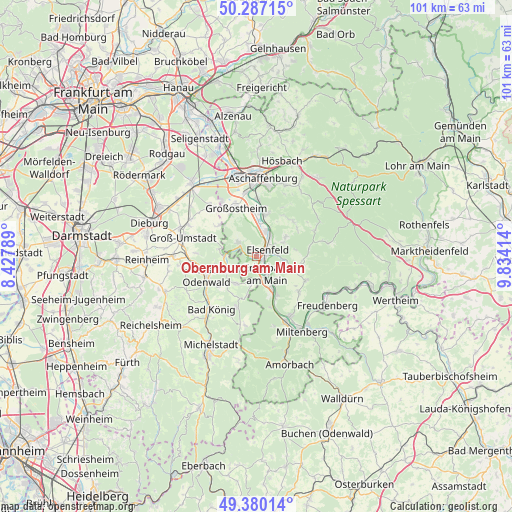
Obernburg am Main GPS coordinates[2]
49° 50' 8.772" North, 9° 7' 51.636" East
| Map corner | latitude | longitude |
|---|---|---|
| Upper-left | 50.28715°, | 8.42789° |
| Center: | 49.83577°, | 9.13101° |
| Lower-right: | 49.38014°, | 9.83414° |
| Map W x H: | 100.9×100.8 km | = 62.7×62.6mi |
| max Lat: | 55.01917° ⇑68% North |
| Obernburg am Main: | 49.83577° |
| min Lat: | ⇓32% South 47.40724° |
| min Long | Obernburg am Ma | max Long |
| 5.92978° | 9.13101° | 14.98853° |
| W 36.5%⇐ | ⇒63.5% E |
Elevation
Elevation of Obernburg am Main is 181 m = 594 ft, and this is 68.1 m = 223 ft below average elevation for this country.
| Max E: |
1256 m = 4121 ft | 56.1% |
| Avg. | 249.1 m = 817 ft | |
| Obernburg am Main | 181 m = 594 ft | |
Min E: |
-5 m = -16 ft | 43.9% |
See also: Germany elevation on elevation.city.
Geographical zone
Obernburg am Main is located in North temperate zone (between Tropic of Cancer and the Arctic Circle). Distance of this North polar circle is 1860 km =1155.8 mi to North.| Distance of | km | miles | from Obernburg am Main |
|---|---|---|---|
| North Pole | 4465.8 | 2774.9 | to North |
| Arctic Circle | 1860 | 1155.8 | to North |
| Tropic Cancer | 2935.3 | 1823.9 | to South |
| Equator | 5541.2 | 3443.1 | to South |


Nearby cities:
15 places around Obernburg am Main: (largest is in red/bold)
• Elsenfeld
2.5 km =1.6 mi,  71°
71°
• Erlenbach am Main
4.3 km =2.7 mi,  147°
147°
• Eschau
9.4 km =5.8 mi,  101°
101°
• Großostheim
10.1 km =6.3 mi,  337°
337°
• Großwallstadt
5.1 km =3.2 mi,  18°
18°
• Hausen
6.8 km =4.2 mi,  56°
56°
• Höchst im Odenwald
10.3 km =6.4 mi,  246°
246°
• Kleinwallstadt
5.1 km =3.2 mi,  32°
32°
• Klingenberg am Main
6.7 km =4.2 mi, 147°
• Leidersbach
9.8 km =6.1 mi,  41°
41°
• Lützelbach
6.6 km =4.1 mi,  217°
217°
• Mömlingen
4.3 km =2.7 mi,  307°
307°
• Niedernberg
8.5 km =5.3 mi,  2°
2°
• Sulzbach am Main
8.6 km =5.3 mi,  10°
10°
• Wörth am Main
4.6 km =2.9 mi,  159°
159°
Sources, notices
• [Note1] Compared only with cities in Germany existing in our database
• [Src1] Map data: © OpenStreetMap contributors (CC-BY-SA)
• [Src2] Other city data from geonames.org with taken over terms of usage.
• [Src3] Geographical zone / Annual Mean Temperature by Robert A. Rohde @ Wikipedia
