Hausen geodata
Hausen (Bavaria) is a seat of a fourth-order administrative division; located in Germany in Europe/Berlin (GMT+2) time zone. With population of 2,033 people, there are 5017 cities with bigger population in this country. Compared to other cities in Germany, 67.2% of cities are located further ↑North; 62.2% of cities are located further →East and 55.5% of cities have higher elevation than Hausen. Note1
Administrative division(s):
- Level 1: Bavaria
- Level 2: Regierungsbezirk Unterfranken
- Level 3: Landkreis Miltenberg
- Level 4: Hausen


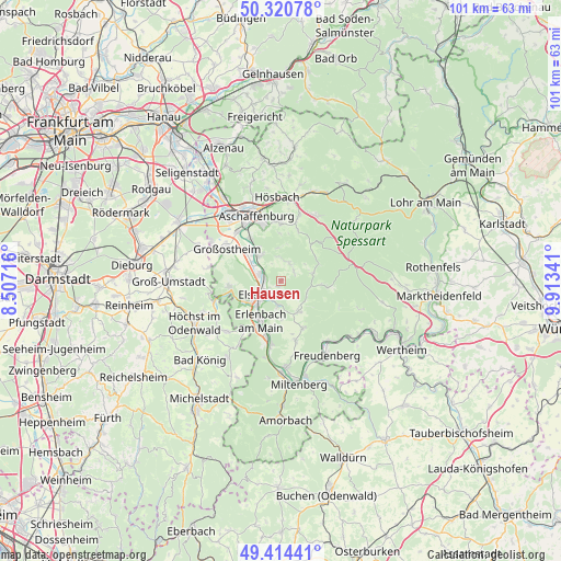
Hausen GPS coordinates[2]
49° 52' 10.992" North, 9° 12' 37.008" East
| Map corner | latitude | longitude |
|---|---|---|
| Upper-left | 50.32078°, | 8.50716° |
| Center: | 49.86972°, | 9.21028° |
| Lower-right: | 49.41441°, | 9.91341° |
| Map W x H: | 100.8×100.8 km | = 62.6×62.6mi |
| max Lat: | 55.01917° ⇑67.2% North |
| Hausen: | 49.86972° |
| min Lat: | ⇓32.8% South 47.40724° |
| min Long | Hausen | max Long |
| 5.92978° | 9.21028° | 14.98853° |
| W 37.8%⇐ | ⇒62.2% E |
Elevation
Elevation of Hausen is 185 m = 607 ft, and this is 64.1 m = 210 ft below average elevation for this country.
| Max E: |
1256 m = 4121 ft | 55.5% |
| Avg. | 249.1 m = 817 ft | |
| Hausen | 185 m = 607 ft | |
Min E: |
-5 m = -16 ft | 44.5% |
See also: Germany elevation on elevation.city.
Geographical zone
Hausen is located in North temperate zone (between Tropic of Cancer and the Arctic Circle). Distance of this North polar circle is 1856.2 km =1153.4 mi to North.| Distance of | km | miles | from Hausen |
|---|---|---|---|
| North Pole | 4462.1 | 2772.6 | to North |
| Arctic Circle | 1856.2 | 1153.4 | to North |
| Tropic Cancer | 2939.1 | 1826.3 | to South |
| Equator | 5545 | 3445.5 | to South |


Nearby cities:
15 places around Hausen: (largest is in red/bold)
• Elsenfeld
4.5 km =2.8 mi,  228°
228°
• Erlenbach am Main
8.1 km =5 mi,  204°
204°
• Eschau
6.7 km =4.2 mi,  148°
148°
• Großwallstadt
4.2 km =2.6 mi,  284°
284°
• Heimbuchenthal
6.5 km =4 mi,  70°
70°
• Kleinwallstadt
3 km =1.9 mi, 280°
• Klingenberg am Main
9.7 km =6 mi,  192°
192°
• Leidersbach
3.6 km =2.2 mi,  13°
13°
• Mespelbrunn
7.7 km =4.8 mi,  49°
49°
• Mömlingen
9.2 km =5.7 mi,  263°
263°
• Mönchberg
9.5 km =5.9 mi, 153°
• Niedernberg
7.1 km =4.4 mi,  311°
311°
• Obernburg am Main
6.8 km =4.2 mi,  236°
236°
• Sulzbach am Main
6.2 km =3.9 mi,  318°
318°
• Wörth am Main
9 km =5.6 mi,  206°
206°
Sources, notices
• [Note1] Compared only with cities in Germany existing in our database
• [Src1] Map data: © OpenStreetMap contributors (CC-BY-SA)
• [Src2] Other city data from geonames.org with taken over terms of usage.
• [Src3] Geographical zone / Annual Mean Temperature by Robert A. Rohde @ Wikipedia
