Mömlingen geodata
Mömlingen (Bavaria) is a seat of a fourth-order administrative division; located in Germany in Europe/Berlin (GMT+2) time zone. With population of 5,066 people, there are 2802 cities with bigger population in this country. Compared to other cities in Germany, 67.6% of cities are located further ↑North; 64.2% of cities are located further →East and 60.6% of cities have higher elevation than Mömlingen. Note1
Administrative division(s):
- Level 1: Bavaria
- Level 2: Regierungsbezirk Unterfranken
- Level 3: Landkreis Miltenberg
- Level 4: Mömlingen


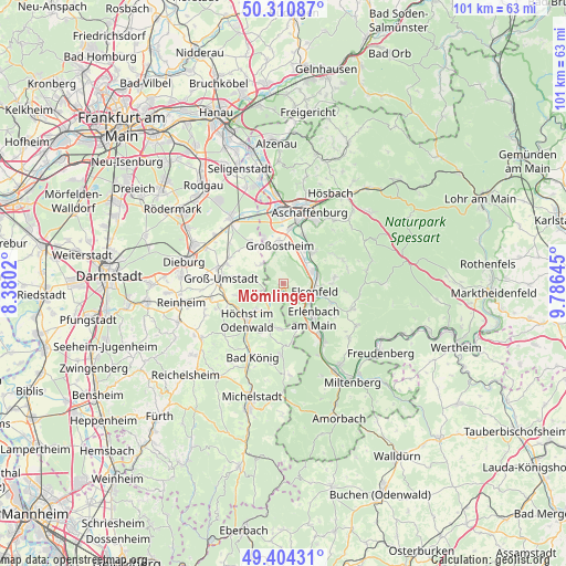
Mömlingen GPS coordinates[2]
49° 51' 34.992" North, 9° 4' 59.988" East
| Map corner | latitude | longitude |
|---|---|---|
| Upper-left | 50.31087°, | 8.3802° |
| Center: | 49.85972°, | 9.08333° |
| Lower-right: | 49.40431°, | 9.78645° |
| Map W x H: | 100.8×100.8 km | = 62.6×62.6mi |
| max Lat: | 55.01917° ⇑67.6% North |
| Mömlingen: | 49.85972° |
| min Lat: | ⇓32.4% South 47.40724° |
| min Long | Mömlingen | max Long |
| 5.92978° | 9.08333° | 14.98853° |
| W 35.8%⇐ | ⇒64.2% E |
Elevation
Elevation of Mömlingen is 148 m = 486 ft, and this is 101.1 m = 332 ft below average elevation for this country.
| Max E: |
1256 m = 4121 ft | 60.6% |
| Avg. | 249.1 m = 817 ft | |
| Mömlingen | 148 m = 486 ft | |
Min E: |
-5 m = -16 ft | 39.4% |
See also: Germany elevation on elevation.city.
Geographical zone
Mömlingen is located in North temperate zone (between Tropic of Cancer and the Arctic Circle). Distance of this North polar circle is 1857.3 km =1154.1 mi to North.| Distance of | km | miles | from Mömlingen |
|---|---|---|---|
| North Pole | 4463.2 | 2773.3 | to North |
| Arctic Circle | 1857.3 | 1154.1 | to North |
| Tropic Cancer | 2938 | 1825.6 | to South |
| Equator | 5543.9 | 3444.8 | to South |


Nearby cities:
15 places around Mömlingen: (largest is in red/bold)
• Elsenfeld
6 km =3.7 mi,  108°
108°
• Erlenbach am Main
8.5 km =5.3 mi,  137°
137°
• Großostheim
6.7 km =4.2 mi,  355°
355°
• Großwallstadt
5.5 km =3.4 mi,  66°
66°
• Hausen
9.2 km =5.7 mi,  83°
83°
• Höchst im Odenwald
9 km =5.6 mi,  222°
222°
• Kleinwallstadt
6.4 km =4 mi, 74°
• Klingenberg am Main
10.8 km =6.7 mi, 140°
• Leidersbach
10.9 km =6.8 mi,  64°
64°
• Lützelbach
8 km =5 mi,  184°
184°
• Niedernberg
7 km =4.3 mi,  33°
33°
• Obernburg am Main
4.3 km =2.7 mi,  127°
127°
• Schaafheim
8.9 km =5.5 mi,  323°
323°
• Sulzbach am Main
7.6 km =4.7 mi,  40°
40°
• Wörth am Main
8.6 km =5.3 mi, 143°
Sources, notices
• [Note1] Compared only with cities in Germany existing in our database
• [Src1] Map data: © OpenStreetMap contributors (CC-BY-SA)
• [Src2] Other city data from geonames.org with taken over terms of usage.
• [Src3] Geographical zone / Annual Mean Temperature by Robert A. Rohde @ Wikipedia
