Obermehler geodata
Obermehler (Thuringia) is a seat of a fourth-order administrative division; located in Germany in Europe/Berlin (GMT+2) time zone. With population of 1,049 people, there are 7006 cities with bigger population in this country. Compared to other cities in Germany, 62.8% of cities are located further ↓South; 60.7% of cities are located further ←West and 56.5% of cities have lower elevation than Obermehler. Note1


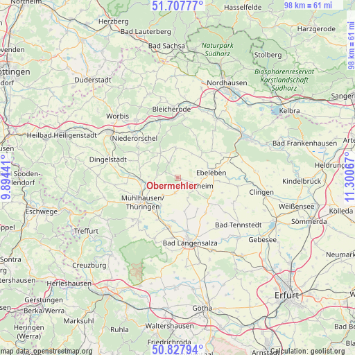
Obermehler GPS coordinates[2]
51° 16' 11.856" North, 10° 35' 51.144" East
| Map corner | latitude | longitude |
|---|---|---|
| Upper-left | 51.70777°, | 9.89441° |
| Center: | 51.26996°, | 10.59754° |
| Lower-right: | 50.82794°, | 11.30067° |
| Map W x H: | 97.8×97.8 km | = 60.8×60.8mi |
| max Lat: | 55.01917° ⇑37.2% North |
| Obermehler: | 51.26996° |
| min Lat: | ⇓62.8% South 47.40724° |
| min Long | Obermehler | max Long |
| 5.92978° | 10.59754° | 14.98853° |
| W 60.7%⇐ | ⇒39.3% E |
Elevation
Elevation of Obermehler is 269 m = 883 ft, and this is 19.9 m = 65 ft above average elevation for this country.
| Max E: |
1256 m = 4121 ft | 43.5% |
| Obermehler | 269 m 883 ft | |
| Avg. | 249.1 m = 817 ft | |
Min E: |
-5 m = -16 ft | 56.5% |
See also: Germany elevation on elevation.city.
Geographical zone
Obermehler is located in North temperate zone (between Tropic of Cancer and the Arctic Circle). Distance of this North polar circle is 1700.5 km =1056.6 mi to North.| Distance of | km | miles | from Obermehler |
|---|---|---|---|
| North Pole | 4306.4 | 2675.9 | to North |
| Arctic Circle | 1700.5 | 1056.6 | to North |
| Tropic Cancer | 3094.8 | 1923 | to South |
| Equator | 5700.7 | 3542.2 | to South |


Nearby cities:
15 places around Obermehler: (largest is in red/bold)
• Abtsbessingen
11.5 km =7.1 mi,  94°
94°
• Bothenheilingen
9.7 km =6 mi,  172°
172°
• Ebeleben
9.3 km =5.8 mi,  81°
81°
• Holzsußra
6.1 km =3.8 mi, 76°
• Issersheilingen
8.6 km =5.3 mi,  154°
154°
• Kleinwelsbach
10.8 km =6.7 mi, 153°
• Körner
4.3 km =2.7 mi,  188°
188°
• Marolterode
7.2 km =4.5 mi,  124°
124°
• Menteroda
4.8 km =3 mi,  330°
330°
• Neunheilingen
10.2 km =6.3 mi, 147°
• Rockstedt
11.6 km =7.2 mi, 81°
• Schlotheim
5 km =3.1 mi, 121°
• Sollstedt
8.8 km =5.5 mi,  300°
300°
• Urbach
2.8 km =1.7 mi,  11°
11°
• Vollenborn
11.2 km =7 mi,  322°
322°
Sources, notices
• [Note1] Compared only with cities in Germany existing in our database
• [Src1] Map data: © OpenStreetMap contributors (CC-BY-SA)
• [Src2] Other city data from geonames.org with taken over terms of usage.
• [Src3] Geographical zone / Annual Mean Temperature by Robert A. Rohde @ Wikipedia
