Oberasbach geodata
Oberasbach (Bavaria) is a populated place; located in Germany in Europe/Berlin (GMT+2) time zone. With population of 17,306 people, there are 921 cities with bigger population in this country. Compared to other cities in Germany, 76.9% of cities are located further ↑North; 66.3% of cities are located further ←West and 64.2% of cities have lower elevation than Oberasbach. Note1
Administrative division(s):
- Level 1: Bavaria
- Level 2: Regierungsbezirk Mittelfranken
- Level 3: Landkreis Fürth
- Level 4: Oberasbach


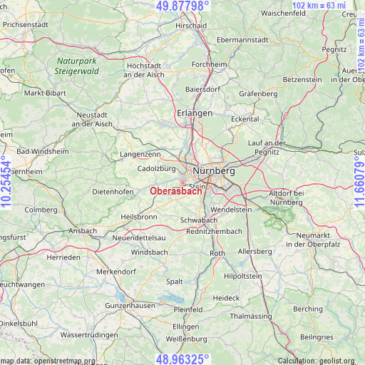
Oberasbach GPS coordinates[2]
49° 25' 21.9" North, 10° 57' 27.576" East
| Map corner | latitude | longitude |
|---|---|---|
| Upper-left | 49.87798°, | 10.25454° |
| Center: | 49.42275°, | 10.95766° |
| Lower-right: | 48.96325°, | 11.66079° |
| Map W x H: | 101.7×101.7 km | = 63.2×63.2mi |
| max Lat: | 55.01917° ⇑76.9% North |
| Oberasbach: | 49.42275° |
| min Lat: | ⇓23.1% South 47.40724° |
| min Long | Oberasbach | max Long |
| 5.92978° | 10.95766° | 14.98853° |
| W 66.3%⇐ | ⇒33.7% E |
Elevation
Elevation of Oberasbach is 316 m = 1037 ft, and this is 66.9 m = 219 ft above average elevation for this country.
| Max E: |
1256 m = 4121 ft | 35.8% |
| Oberasbach | 316 m 1037 ft | |
| Avg. | 249.1 m = 817 ft | |
Min E: |
-5 m = -16 ft | 64.2% |
See also: Germany elevation on elevation.city.
Geographical zone
Oberasbach is located in North temperate zone (between Tropic of Cancer and the Arctic Circle). Distance of this North polar circle is 1905.9 km =1184.3 mi to North.| Distance of | km | miles | from Oberasbach |
|---|---|---|---|
| North Pole | 4511.8 | 2803.5 | to North |
| Arctic Circle | 1905.9 | 1184.3 | to North |
| Tropic Cancer | 2889.4 | 1795.4 | to South |
| Equator | 5495.3 | 3414.6 | to South |


Nearby cities:
15 places around Oberasbach: (largest is in red/bold)
• Ammerndorf
7.8 km =4.8 mi,  270°
270°
• Cadolzburg
8.5 km =5.3 mi,  296°
296°
• Fürth
6.3 km =3.9 mi,  20°
20°
• Großhabersdorf
12.9 km =8 mi,  258°
258°
• Großreuth bei Schweinau
4.9 km =3 mi,  74°
74°
• Nürnberg
9.3 km =5.8 mi, 68°
• Obermichelbach
12.6 km =7.8 mi,  343°
343°
• Rohr
10.3 km =6.4 mi,  208°
208°
• Roßtal
5.8 km =3.6 mi,  238°
238°
• Schwabach
11.3 km =7 mi,  155°
155°
• Seukendorf
9.2 km =5.7 mi,  322°
322°
• Stein
4.3 km =2.7 mi,  100°
100°
• Veitsbronn
11.2 km =7 mi,  333°
333°
• Wetzendorf
8.1 km =5 mi,  48°
48°
• Zirndorf
2.2 km =1.4 mi,  353°
353°
Sources, notices
• [Note1] Compared only with cities in Germany existing in our database
• [Src1] Map data: © OpenStreetMap contributors (CC-BY-SA)
• [Src2] Other city data from geonames.org with taken over terms of usage.
• [Src3] Geographical zone / Annual Mean Temperature by Robert A. Rohde @ Wikipedia
