Schwabach geodata
Schwabach (Bavaria) is a seat of a third-order administrative division; located in Germany in Europe/Berlin (GMT+2) time zone. With population of 38,554 people, there are 340 cities with bigger population in this country. Compared to other cities in Germany, 78.2% of cities are located further ↑North; 67.3% of cities are located further ←West and 66% of cities have lower elevation than Schwabach. Note1
Administrative division(s):
- Level 1: Bavaria
- Level 2: Regierungsbezirk Mittelfranken
- Level 3: Kreisfreie Stadt Schwabach
- Level 4: Schwabach


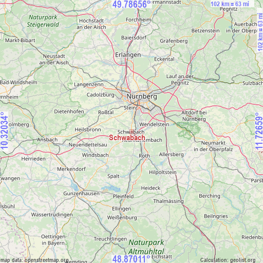
Schwabach GPS coordinates[2]
49° 19' 49.692" North, 11° 1' 24.456" East
| Map corner | latitude | longitude |
|---|---|---|
| Upper-left | 49.78656°, | 10.32034° |
| Center: | 49.33047°, | 11.02346° |
| Lower-right: | 48.87011°, | 11.72659° |
| Map W x H: | 101.9×101.9 km | = 63.3×63.3mi |
| max Lat: | 55.01917° ⇑78.2% North |
| Schwabach: | 49.33047° |
| min Lat: | ⇓21.8% South 47.40724° |
| min Long | Schwabach | max Long |
| 5.92978° | 11.02346° | 14.98853° |
| W 67.3%⇐ | ⇒32.7% E |
Elevation
Elevation of Schwabach is 328 m = 1076 ft, and this is 78.9 m = 259 ft above average elevation for this country.
| Max E: |
1256 m = 4121 ft | 34% |
| Schwabach | 328 m 1076 ft | |
| Avg. | 249.1 m = 817 ft | |
Min E: |
-5 m = -16 ft | 66% |
See also: Germany elevation on elevation.city.
Geographical zone
Schwabach is located in North temperate zone (between Tropic of Cancer and the Arctic Circle). Distance of this North polar circle is 1916.1 km =1190.6 mi to North.| Distance of | km | miles | from Schwabach |
|---|---|---|---|
| North Pole | 4522 | 2809.8 | to North |
| Arctic Circle | 1916.1 | 1190.6 | to North |
| Tropic Cancer | 2879.1 | 1789 | to South |
| Equator | 5485 | 3408.2 | to South |


Nearby cities:
15 places around Schwabach: (largest is in red/bold)
• Abenberg
10.7 km =6.6 mi,  203°
203°
• Büchenbach
7.4 km =4.6 mi,  159°
159°
• Feucht
14.7 km =9.1 mi,  69°
69°
• Großreuth bei Schweinau
11.6 km =7.2 mi,  359°
359°
• Kammerstein
5.5 km =3.4 mi,  221°
221°
• Nürnberg
14.3 km =8.9 mi,  15°
15°
• Oberasbach
11.3 km =7 mi,  335°
335°
• Rednitzhembach
5.2 km =3.2 mi,  128°
128°
• Rohr
9.8 km =6.1 mi,  276°
276°
• Roth
10.4 km =6.5 mi,  151°
151°
• Roßtal
12.2 km =7.6 mi,  306°
306°
• Stein
9.5 km =5.9 mi, 356°
• Wendelstein
9.5 km =5.9 mi,  75°
75°
• Wetzendorf
15.6 km =9.7 mi,  4°
4°
• Zirndorf
13.4 km =8.3 mi, 338°
Sources, notices
• [Note1] Compared only with cities in Germany existing in our database
• [Src1] Map data: © OpenStreetMap contributors (CC-BY-SA)
• [Src2] Other city data from geonames.org with taken over terms of usage.
• [Src3] Geographical zone / Annual Mean Temperature by Robert A. Rohde @ Wikipedia
