Nochern geodata
Nochern (Rheinland-Pfalz) is a seat of a fourth-order administrative division; located in Germany in Europe/Berlin (GMT+2) time zone. With population of 545 people, there are 9114 cities with bigger population in this country. Compared to other cities in Germany, 59.7% of cities are located further ↑North; 82.8% of cities are located further →East and 53.6% of cities have lower elevation than Nochern. Note1


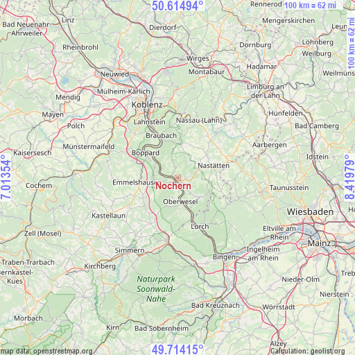
Nochern GPS coordinates[2]
50° 10' 0.012" North, 7° 43' 0.012" East
| Map corner | latitude | longitude |
|---|---|---|
| Upper-left | 50.61494°, | 7.01354° |
| Center: | 50.16667°, | 7.71667° |
| Lower-right: | 49.71415°, | 8.41979° |
| Map W x H: | 100.2×100.2 km | = 62.3×62.3mi |
| max Lat: | 55.01917° ⇑59.7% North |
| Nochern: | 50.16667° |
| min Lat: | ⇓40.3% South 47.40724° |
| min Long | Nochern | max Long |
| 5.92978° | 7.71667° | 14.98853° |
| W 17.2%⇐ | ⇒82.8% E |
Elevation
Elevation of Nochern is 250 m = 820 ft, and this is 0.90000000000001 m = 3 ft above average elevation for this country.
| Max E: |
1256 m = 4121 ft | 46.4% |
| Nochern | 250 m 820 ft | |
| Avg. | 249.1 m = 817 ft | |
Min E: |
-5 m = -16 ft | 53.6% |
See also: Germany elevation on elevation.city.
Geographical zone
Nochern is located in North temperate zone (between Tropic of Cancer and the Arctic Circle). Distance of this North polar circle is 1823.2 km =1132.9 mi to North.| Distance of | km | miles | from Nochern |
|---|---|---|---|
| North Pole | 4429.1 | 2752.1 | to North |
| Arctic Circle | 1823.2 | 1132.9 | to North |
| Tropic Cancer | 2972.1 | 1846.8 | to South |
| Equator | 5578 | 3466 | to South |


Nearby cities:
15 places around Nochern: (largest is in red/bold)
• Auel
3.6 km =2.2 mi,  90°
90°
• Bornich
5.6 km =3.5 mi,  141°
141°
• Dahlheim
5.1 km =3.2 mi,  342°
342°
• Eschbach
5.3 km =3.3 mi,  8°
8°
• Kestert
5.1 km =3.2 mi,  291°
291°
• Lierschied
2.4 km =1.5 mi, 90°
• Lykershausen
5.1 km =3.2 mi,  316°
316°
• Patersberg
2.2 km =1.4 mi,  147°
147°
• Prath
4 km =2.5 mi, 324°
• Reichenberg
4 km =2.5 mi,  117°
117°
• Reitzenhain
5.1 km =3.2 mi,  111°
111°
• Sankt Goar
2.1 km =1.3 mi,  198°
198°
• Sankt Goarshausen
0.9 km =0.6 mi,  192°
192°
• Urbar
3.7 km =2.3 mi,  180°
180°
• Weyer
1.9 km =1.2 mi,  0°
0°
Sources, notices
• [Note1] Compared only with cities in Germany existing in our database
• [Src1] Map data: © OpenStreetMap contributors (CC-BY-SA)
• [Src2] Other city data from geonames.org with taken over terms of usage.
• [Src3] Geographical zone / Annual Mean Temperature by Robert A. Rohde @ Wikipedia
