Niederstriegis geodata
Niederstriegis (Saxony) is a populated place; located in Germany in Europe/Berlin (GMT+2) time zone. With population of 1,317 people, there are 6258 cities with bigger population in this country. Compared to other cities in Germany, 59.5% of cities are located further ↓South; 93.3% of cities are located further ←West and 54.9% of cities have higher elevation than Niederstriegis. Note1


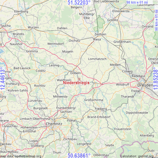
Niederstriegis GPS coordinates[2]
51° 4' 56.748" North, 13° 8' 57.3" East
| Map corner | latitude | longitude |
|---|---|---|
| Upper-left | 51.52203°, | 12.44613° |
| Center: | 51.08243°, | 13.14925° |
| Lower-right: | 50.63861°, | 13.85238° |
| Map W x H: | 98.2×98.2 km | = 61×61mi |
| max Lat: | 55.01917° ⇑40.5% North |
| Niederstriegis: | 51.08243° |
| min Lat: | ⇓59.5% South 47.40724° |
| min Long | Niederstriegis | max Long |
| 5.92978° | 13.14925° | 14.98853° |
| W 93.3%⇐ | ⇒6.7% E |
Elevation
Elevation of Niederstriegis is 190 m = 623 ft, and this is 59.1 m = 194 ft below average elevation for this country.
| Max E: |
1256 m = 4121 ft | 54.9% |
| Avg. | 249.1 m = 817 ft | |
| Niederstriegis | 190 m = 623 ft | |
Min E: |
-5 m = -16 ft | 45.1% |
See also: Germany elevation on elevation.city.
Geographical zone
Niederstriegis is located in North temperate zone (between Tropic of Cancer and the Arctic Circle). Distance of this North polar circle is 1721.3 km =1069.6 mi to North.| Distance of | km | miles | from Niederstriegis |
|---|---|---|---|
| North Pole | 4327.2 | 2688.8 | to North |
| Arctic Circle | 1721.3 | 1069.6 | to North |
| Tropic Cancer | 3073.9 | 1910 | to South |
| Equator | 5679.8 | 3529.3 | to South |


Nearby cities:
15 places around Niederstriegis: (largest is in red/bold)
• Döbeln
5.2 km =3.2 mi,  328°
328°
• Ebersbach
3.1 km =1.9 mi,  306°
306°
• Gersdorf
15.1 km =9.4 mi,  282°
282°
• Großschirma
16.1 km =10 mi,  143°
143°
• Großweitzschen
11.1 km =6.9 mi,  319°
319°
• Hainichen
12.6 km =7.8 mi,  188°
188°
• Hartha
12.4 km =7.7 mi, 278°
• Kriebstein
9.9 km =6.2 mi,  248°
248°
• Mittweida
16.2 km =10.1 mi,  228°
228°
• Mochau
6.1 km =3.8 mi,  22°
22°
• Nossen
10.6 km =6.6 mi,  104°
104°
• Ostrau
13.1 km =8.1 mi,  5°
5°
• Rossau
10.8 km =6.7 mi,  212°
212°
• Roßwein
3 km =1.9 mi,  127°
127°
• Waldheim
9.1 km =5.7 mi,  263°
263°
Sources, notices
• [Note1] Compared only with cities in Germany existing in our database
• [Src1] Map data: © OpenStreetMap contributors (CC-BY-SA)
• [Src2] Other city data from geonames.org with taken over terms of usage.
• [Src3] Geographical zone / Annual Mean Temperature by Robert A. Rohde @ Wikipedia
