Niederfüllbach geodata
Niederfüllbach (Bavaria) is a seat of a fourth-order administrative division; located in Germany in Europe/Berlin (GMT+2) time zone. With population of 1,672 people, there are 5568 cities with bigger population in this country. Compared to other cities in Germany, 58.6% of cities are located further ↑North; 66.9% of cities are located further ←West and 59.7% of cities have lower elevation than Niederfüllbach. Note1
Administrative division(s):
- Level 1: Bavaria
- Level 2: Upper Franconia
- Level 3: Landkreis Coburg
- Level 4: Niederfüllbach


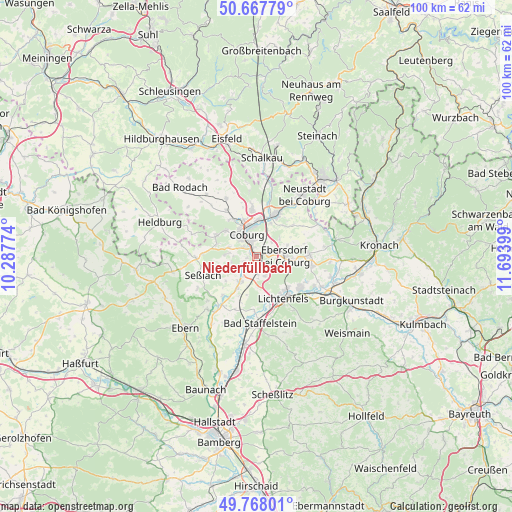
Niederfüllbach GPS coordinates[2]
50° 13' 12.072" North, 10° 59' 27.096" East
| Map corner | latitude | longitude |
|---|---|---|
| Upper-left | 50.66779°, | 10.28774° |
| Center: | 50.22002°, | 10.99086° |
| Lower-right: | 49.76801°, | 11.69399° |
| Map W x H: | 100×100 km | = 62.1×62.1mi |
| max Lat: | 55.01917° ⇑58.6% North |
| Niederfüllbach: | 50.22002° |
| min Lat: | ⇓41.4% South 47.40724° |
| min Long | Niederfüllbach | max Long |
| 5.92978° | 10.99086° | 14.98853° |
| W 66.9%⇐ | ⇒33.1% E |
Elevation
Elevation of Niederfüllbach is 288 m = 945 ft, and this is 38.9 m = 128 ft above average elevation for this country.
| Max E: |
1256 m = 4121 ft | 40.3% |
| Niederfüllbach | 288 m 945 ft | |
| Avg. | 249.1 m = 817 ft | |
Min E: |
-5 m = -16 ft | 59.7% |
See also: Germany elevation on elevation.city.
Geographical zone
Niederfüllbach is located in North temperate zone (between Tropic of Cancer and the Arctic Circle). Distance of this North polar circle is 1817.2 km =1129.2 mi to North.| Distance of | km | miles | from Niederfüllbach |
|---|---|---|---|
| North Pole | 4423.1 | 2748.4 | to North |
| Arctic Circle | 1817.2 | 1129.2 | to North |
| Tropic Cancer | 2978 | 1850.4 | to South |
| Equator | 5583.9 | 3469.7 | to South |


Nearby cities:
15 places around Niederfüllbach: (largest is in red/bold)
• Ahorn
3.3 km =2.1 mi,  306°
306°
• Bad Staffelstein
13.1 km =8.1 mi,  176°
176°
• Coburg
4.8 km =3 mi,  336°
336°
• Großheirath
5.7 km =3.5 mi,  210°
210°
• Lautertal
12.7 km =7.9 mi,  352°
352°
• Lichtenfels
9.6 km =6 mi,  149°
149°
• Meeder
12.7 km =7.9 mi,  332°
332°
• Michelau
10.8 km =6.7 mi,  126°
126°
• Rödental
9.1 km =5.7 mi,  23°
23°
• Seßlach
11.1 km =6.9 mi,  252°
252°
• Sonnefeld
10.1 km =6.3 mi,  92°
92°
• Ummerstadt
13.5 km =8.4 mi,  288°
288°
• Untersiemau
3.1 km =1.9 mi,  202°
202°
• Weidhausen bei Coburg
10.8 km =6.7 mi,  99°
99°
• Weitramsdorf
8.8 km =5.5 mi,  296°
296°
Sources, notices
• [Note1] Compared only with cities in Germany existing in our database
• [Src1] Map data: © OpenStreetMap contributors (CC-BY-SA)
• [Src2] Other city data from geonames.org with taken over terms of usage.
• [Src3] Geographical zone / Annual Mean Temperature by Robert A. Rohde @ Wikipedia
