Neresheim geodata
Neresheim (Baden-Württemberg) is a populated place; located in Germany in Europe/Berlin (GMT+2) time zone. With population of 8,271 people, there are 1910 cities with bigger population in this country. Compared to other cities in Germany, 85.8% of cities are located further ↑North; 55.9% of cities are located further ←West and 88.8% of cities have lower elevation than Neresheim. Note1
Administrative division(s):
- Level 1: Baden-Württemberg
- Level 2: Regierungsbezirk Stuttgart
- Level 3: Ostalbkreis
- Level 4: Neresheim


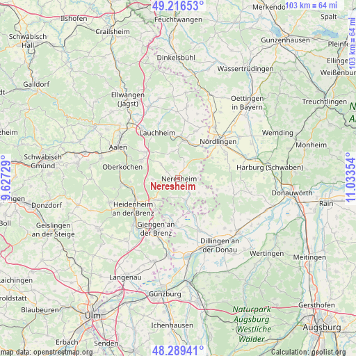
Neresheim GPS coordinates[2]
48° 45' 18.396" North, 10° 19' 49.476" East
| Map corner | latitude | longitude |
|---|---|---|
| Upper-left | 49.21653°, | 9.62729° |
| Center: | 48.75511°, | 10.33041° |
| Lower-right: | 48.28941°, | 11.03354° |
| Map W x H: | 103.1×103.1 km | = 64.1×64.1mi |
| max Lat: | 55.01917° ⇑85.8% North |
| Neresheim: | 48.75511° |
| min Lat: | ⇓14.2% South 47.40724° |
| min Long | Neresheim | max Long |
| 5.92978° | 10.33041° | 14.98853° |
| W 55.9%⇐ | ⇒44.1% E |
Elevation
Elevation of Neresheim is 502 m = 1647 ft, and this is 252.9 m = 830 ft above average elevation for this country.
| Max E: |
1256 m = 4121 ft | 11.2% |
| Neresheim | 502 m 1647 ft | |
| Avg. | 249.1 m = 817 ft | |
Min E: |
-5 m = -16 ft | 88.8% |
See also: Germany elevation on elevation.city.
Geographical zone
Neresheim is located in North temperate zone (between Tropic of Cancer and the Arctic Circle). Distance of this North polar circle is 1980.1 km =1230.4 mi to North.| Distance of | km | miles | from Neresheim |
|---|---|---|---|
| North Pole | 4586 | 2849.6 | to North |
| Arctic Circle | 1980.1 | 1230.4 | to North |
| Tropic Cancer | 2815.1 | 1749.2 | to South |
| Equator | 5421.1 | 3368.5 | to South |


Nearby cities:
15 places around Neresheim: (largest is in red/bold)
• Amerdingen
11.8 km =7.3 mi,  106°
106°
• Bachhagel
13.7 km =8.5 mi,  183°
183°
• Bopfingen
11.6 km =7.2 mi,  8°
8°
• Dischingen
6.7 km =4.2 mi,  156°
156°
• Ederheim
11.6 km =7.2 mi,  59°
59°
• Forheim
8.9 km =5.5 mi,  81°
81°
• Heidenheim an der Brenz
15.7 km =9.8 mi,  236°
236°
• Hohenaltheim
15.3 km =9.5 mi, 77°
• Kirchheim am Ries
14.7 km =9.1 mi,  20°
20°
• Lauchheim
14.4 km =8.9 mi,  333°
333°
• Mödingen
14.5 km =9 mi,  149°
149°
• Nattheim
8.9 km =5.5 mi,  226°
226°
• Reimlingen
15.3 km =9.5 mi, 63°
• Ziertheim
12.5 km =7.8 mi, 156°
• Zöschingen
9.1 km =5.7 mi, 182°
Sources, notices
• [Note1] Compared only with cities in Germany existing in our database
• [Src1] Map data: © OpenStreetMap contributors (CC-BY-SA)
• [Src2] Other city data from geonames.org with taken over terms of usage.
• [Src3] Geographical zone / Annual Mean Temperature by Robert A. Rohde @ Wikipedia
