Nauen geodata
Nauen (Brandenburg) is a populated place; located in Germany in Europe/Berlin (GMT+2) time zone. With population of 16,600 people, there are 951 cities with bigger population in this country. Compared to other cities in Germany, 78.8% of cities are located further ↓South; 91.3% of cities are located further ←West and 84.1% of cities have higher elevation than Nauen. Note1


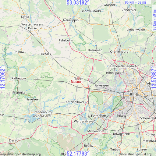
Nauen GPS coordinates[2]
52° 36' 25.236" North, 12° 52' 25.464" East
| Map corner | latitude | longitude |
|---|---|---|
| Upper-left | 53.03192°, | 12.17062° |
| Center: | 52.60701°, | 12.87374° |
| Lower-right: | 52.17793°, | 13.57687° |
| Map W x H: | 95×95 km | = 59×59mi |
| max Lat: | 55.01917° ⇑21.2% North |
| Nauen: | 52.60701° |
| min Lat: | ⇓78.8% South 47.40724° |
| min Long | Nauen | max Long |
| 5.92978° | 12.87374° | 14.98853° |
| W 91.3%⇐ | ⇒8.7% E |
Elevation
Elevation of Nauen is 37 m = 121 ft, and this is 212.1 m = 696 ft below average elevation for this country.
| Max E: |
1256 m = 4121 ft | 84.1% |
| Avg. | 249.1 m = 817 ft | |
| Nauen | 37 m = 121 ft | |
Min E: |
-5 m = -16 ft | 15.9% |
See also: Germany elevation on elevation.city.
Geographical zone
Nauen is located in North temperate zone (between Tropic of Cancer and the Arctic Circle). Distance of this North polar circle is 1551.8 km =964.2 mi to North.| Distance of | km | miles | from Nauen |
|---|---|---|---|
| North Pole | 4157.7 | 2583.5 | to North |
| Arctic Circle | 1551.8 | 964.2 | to North |
| Tropic Cancer | 3243.4 | 2015.4 | to South |
| Equator | 5849.4 | 3634.6 | to South |


Nearby cities:
15 places around Nauen: (largest is in red/bold)
• Brieselang
8.9 km =5.5 mi,  107°
107°
• Dallgow-Döberitz
14.4 km =8.9 mi,  119°
119°
• Falkenhagener Feld
20.8 km =12.9 mi, 107°
• Falkensee
15.7 km =9.8 mi, 109°
• Jahnberge
16.8 km =10.4 mi,  319°
319°
• Ketzin
14.5 km =9 mi,  187°
187°
• Kremmen
20 km =12.4 mi,  30°
30°
• Paulinenaue
13.5 km =8.4 mi,  305°
305°
• Pessin
14.5 km =9 mi,  285°
285°
• Päwesin
14.6 km =9.1 mi,  226°
226°
• Retzow
12.9 km =8 mi,  278°
278°
• Roskow
18.3 km =11.4 mi,  214°
214°
• Staaken
20.3 km =12.6 mi, 112°
• Velten
22.4 km =13.9 mi,  65°
65°
• Wustermark
8.2 km =5.1 mi,  140°
140°
Sources, notices
• [Note1] Compared only with cities in Germany existing in our database
• [Src1] Map data: © OpenStreetMap contributors (CC-BY-SA)
• [Src2] Other city data from geonames.org with taken over terms of usage.
• [Src3] Geographical zone / Annual Mean Temperature by Robert A. Rohde @ Wikipedia
