Jahnberge geodata
Jahnberge (Brandenburg) is a populated place; located in Germany in Europe/Berlin (GMT+2) time zone. With population of 785 people, there are 7961 cities with bigger population in this country. Compared to other cities in Germany, 79.8% of cities are located further ↓South; 89.9% of cities are located further ←West and 87.7% of cities have higher elevation than Jahnberge. Note1


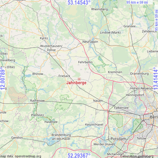
Jahnberge GPS coordinates[2]
52° 43' 17.868" North, 12° 42' 39.636" East
| Map corner | latitude | longitude |
|---|---|---|
| Upper-left | 53.14543°, | 12.00789° |
| Center: | 52.72163°, | 12.71101° |
| Lower-right: | 52.29367°, | 13.41414° |
| Map W x H: | 94.7×94.7 km | = 58.8×58.8mi |
| max Lat: | 55.01917° ⇑20.2% North |
| Jahnberge: | 52.72163° |
| min Lat: | ⇓79.8% South 47.40724° |
| min Long | Jahnberge | max Long |
| 5.92978° | 12.71101° | 14.98853° |
| W 89.9%⇐ | ⇒10.1% E |
Elevation
Elevation of Jahnberge is 28 m = 92 ft, and this is 221.1 m = 725 ft below average elevation for this country.
| Max E: |
1256 m = 4121 ft | 87.7% |
| Avg. | 249.1 m = 817 ft | |
| Jahnberge | 28 m = 92 ft | |
Min E: |
-5 m = -16 ft | 12.3% |
See also: Germany elevation on elevation.city.
Geographical zone
Jahnberge is located in North temperate zone (between Tropic of Cancer and the Arctic Circle). Distance of this North polar circle is 1539.1 km =956.4 mi to North.| Distance of | km | miles | from Jahnberge |
|---|---|---|---|
| North Pole | 4145 | 2575.6 | to North |
| Arctic Circle | 1539.1 | 956.4 | to North |
| Tropic Cancer | 3256.2 | 2023.3 | to South |
| Equator | 5862.1 | 3642.5 | to South |


Nearby cities:
15 places around Jahnberge: (largest is in red/bold)
• Dabergotz
20.2 km =12.6 mi,  2°
2°
• Dreetz
19.2 km =11.9 mi,  298°
298°
• Fehrbellin
10.8 km =6.7 mi,  19°
19°
• Friesack
9 km =5.6 mi,  281°
281°
• Großderschau
24.3 km =15.1 mi,  288°
288°
• Kotzen
16.4 km =10.2 mi,  233°
233°
• Kremmen
21.6 km =13.4 mi,  77°
77°
• Nauen
16.8 km =10.4 mi,  139°
139°
• Nennhausen
19.6 km =12.2 mi, 226°
• Neuruppin
23.8 km =14.8 mi, 15°
• Paulinenaue
5 km =3.1 mi,  180°
180°
• Pessin
9.3 km =5.8 mi,  198°
198°
• Päwesin
22.8 km =14.2 mi, 179°
• Retzow
10.9 km =6.8 mi,  189°
189°
• Walsleben
24.3 km =15.1 mi,  352°
352°
Sources, notices
• [Note1] Compared only with cities in Germany existing in our database
• [Src1] Map data: © OpenStreetMap contributors (CC-BY-SA)
• [Src2] Other city data from geonames.org with taken over terms of usage.
• [Src3] Geographical zone / Annual Mean Temperature by Robert A. Rohde @ Wikipedia
