Morgenröthe-Rautenkranz geodata
Morgenröthe-Rautenkranz (Saxony) is a populated place; located in Germany in Europe/Berlin (GMT+2) time zone. With population of 893 people, there are 7548 cities with bigger population in this country. Compared to other cities in Germany, 53.8% of cities are located further ↑North; 88.1% of cities are located further ←West and 98.1% of cities have lower elevation than Morgenröthe-Rautenkranz. Note1
Current local time in Morgenröthe-Rautenkranz:
03:52 PM, TuesdayDifference from your time zone: hours


Morgenröthe-Rautenkranz GPS coordinates[2]
50° 26' 46.68" North, 12° 30' 47.088" East
| Map corner | latitude | longitude |
|---|---|---|
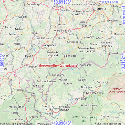
| Upper-left | 50.89193°, | 11.80996° |
| Center: | 50.4463°, | 12.51308° |
| Lower-right: | 49.99643°, | 13.21621° |
| Map W x H: | 99.6×99.6 km | = 61.9×61.9mi |
| max Lat: | 55.01917° ⇑53.8% North |
| Morgenröthe-Rautenkranz: | 50.4463° |
| min Lat: | ⇓46.2% South 47.40724° |
| min Long | Morgenröthe-Ra | max Long |
| 5.92978° | 12.51308° | 14.98853° |
| W 88.1%⇐ | ⇒11.9% E |
Elevation
Elevation of Morgenröthe-Rautenkranz is 713 m = 2339 ft, and this is 463.9 m = 1522 ft above average elevation for this country.
| Max E: |
1256 m = 4121 ft | 1.9% |
| Morgenröthe-Rautenkranz | 713 m 2339 ft | |
| Avg. | 249.1 m = 817 ft | |
Min E: |
-5 m = -16 ft | 98.1% |
See also: Germany elevation on elevation.city.
Geographical zone
Morgenröthe-Rautenkranz is located in North temperate zone (between Tropic of Cancer and the Arctic Circle). Distance of this North polar circle is 1792.1 km =1113.6 mi to North.| Distance of | km | miles | from Morgenröthe-Rautenkranz |
|---|---|---|---|
| North Pole | 4398 | 2732.8 | to North |
| Arctic Circle | 1792.1 | 1113.6 | to North |
| Tropic Cancer | 3003.2 | 1866.1 | to South |
| Equator | 5609.1 | 3485.3 | to South |


Nearby cities:
15 places around Morgenröthe-Rautenkranz: (largest is in red/bold)
• Auerbach
10.8 km =6.7 mi,  312°
312°
• Eibenstock
8.1 km =5 mi,  48°
48°
• Ellefeld
9.7 km =6 mi,  295°
295°
• Falkenstein
10.6 km =6.6 mi,  289°
289°
• Grünbach
10.7 km =6.6 mi,  272°
272°
• Hammerbrücke
7.1 km =4.4 mi,  259°
259°
• Klingenthal
10.2 km =6.3 mi,  199°
199°
• Muldenhammer
2.1 km =1.3 mi,  281°
281°
• Neustadt Vogtland
12.9 km =8 mi, 277°
• Rodewisch
11.8 km =7.3 mi,  323°
323°
• Schönheide
6.5 km =4 mi,  5°
5°
• Sosa
11.4 km =7.1 mi,  58°
58°
• Stützengrün
9.8 km =6.1 mi, 8°
• Tannenbergsthal
4.1 km =2.5 mi,  254°
254°
• Zwota
12.4 km =7.7 mi,  211°
211°
Sources, notices
• [Note1] Compared only with cities in Germany existing in our database
• [Src1] Map data: © OpenStreetMap contributors (CC-BY-SA)
• [Src2] Other city data from geonames.org with taken over terms of usage.
• [Src3] Geographical zone / Annual Mean Temperature by Robert A. Rohde @ Wikipedia
