Klingenthal geodata
Klingenthal (Saxony) is a populated place; located in Germany in Europe/Berlin (GMT+2) time zone. With population of 9,132 people, there are 1764 cities with bigger population in this country. Compared to other cities in Germany, 55.4% of cities are located further ↑North; 87.6% of cities are located further ←West and 95.2% of cities have lower elevation than Klingenthal. Note1


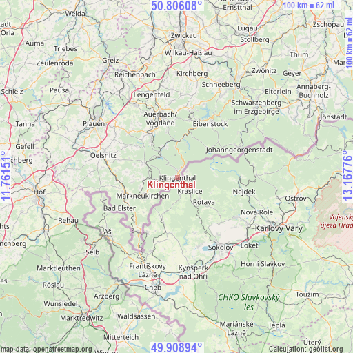
Klingenthal GPS coordinates[2]
50° 21' 34.668" North, 12° 27' 52.668" East
| Map corner | latitude | longitude |
|---|---|---|
| Upper-left | 50.80608°, | 11.76151° |
| Center: | 50.35963°, | 12.46463° |
| Lower-right: | 49.90894°, | 13.16776° |
| Map W x H: | 99.8×99.8 km | = 62×62mi |
| max Lat: | 55.01917° ⇑55.4% North |
| Klingenthal: | 50.35963° |
| min Lat: | ⇓44.6% South 47.40724° |
| min Long | Klingenthal | max Long |
| 5.92978° | 12.46463° | 14.98853° |
| W 87.6%⇐ | ⇒12.4% E |
Elevation
Elevation of Klingenthal is 604 m = 1982 ft, and this is 354.9 m = 1164 ft above average elevation for this country.
| Max E: |
1256 m = 4121 ft | 4.8% |
| Klingenthal | 604 m 1982 ft | |
| Avg. | 249.1 m = 817 ft | |
Min E: |
-5 m = -16 ft | 95.2% |
See also: Germany elevation on elevation.city.
Geographical zone
Klingenthal is located in North temperate zone (between Tropic of Cancer and the Arctic Circle). Distance of this North polar circle is 1801.7 km =1119.5 mi to North.| Distance of | km | miles | from Klingenthal |
|---|---|---|---|
| North Pole | 4407.6 | 2738.8 | to North |
| Arctic Circle | 1801.7 | 1119.5 | to North |
| Tropic Cancer | 2993.5 | 1860.1 | to South |
| Equator | 5599.5 | 3479.4 | to South |


Nearby cities:
15 places around Klingenthal: (largest is in red/bold)
• Adorf
15.2 km =9.4 mi,  253°
253°
• Ellefeld
14.8 km =9.2 mi,  338°
338°
• Erlbach
8.4 km =5.2 mi,  235°
235°
• Falkenstein
14.7 km =9.1 mi,  333°
333°
• Grünbach
12.4 km =7.7 mi,  324°
324°
• Hammerbrücke
9.1 km =5.7 mi, 337°
• Markneukirchen
11 km =6.8 mi, 240°
• Morgenröthe-Rautenkranz
10.2 km =6.3 mi,  19°
19°
• Muldenhammer
10.1 km =6.3 mi,  7°
7°
• Neustadt Vogtland
14.7 km =9.1 mi, 320°
• Pöhl
10.3 km =6.4 mi,  291°
291°
• Schöneck
10.3 km =6.4 mi, 289°
• Tannenbergsthal
8.6 km =5.3 mi,  356°
356°
• Werda
14.3 km =8.9 mi,  307°
307°
• Zwota
3.1 km =1.9 mi, 252°
Sources, notices
• [Note1] Compared only with cities in Germany existing in our database
• [Src1] Map data: © OpenStreetMap contributors (CC-BY-SA)
• [Src2] Other city data from geonames.org with taken over terms of usage.
• [Src3] Geographical zone / Annual Mean Temperature by Robert A. Rohde @ Wikipedia
