Grünbach geodata
Grünbach (Saxony) is a populated place; located in Germany in Europe/Berlin (GMT+2) time zone. With population of 1,927 people, there are 5171 cities with bigger population in this country. Compared to other cities in Germany, 53.8% of cities are located further ↑North; 86.5% of cities are located further ←West and 97.8% of cities have lower elevation than Grünbach. Note1
Administrative division(s):
- Level 1: Saxony
- Level 3: Vogtlandkreis
- Level 4: Grünbach, Höhenluftkurort


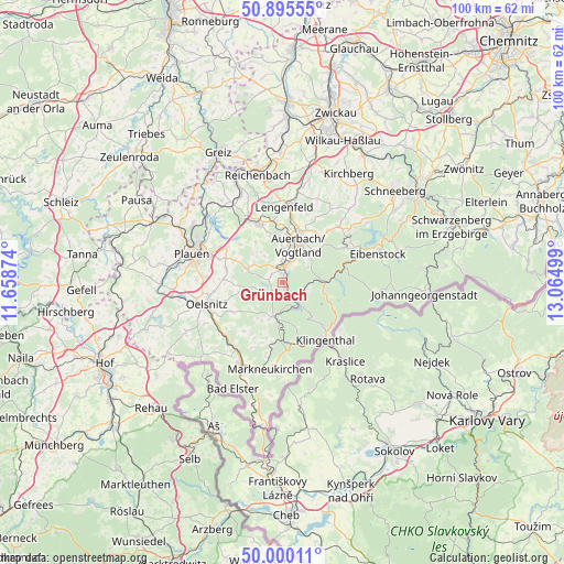
Grünbach GPS coordinates[2]
50° 26' 59.82" North, 12° 21' 42.696" East
| Map corner | latitude | longitude |
|---|---|---|
| Upper-left | 50.89555°, | 11.65874° |
| Center: | 50.44995°, | 12.36186° |
| Lower-right: | 50.00011°, | 13.06499° |
| Map W x H: | 99.6×99.6 km | = 61.9×61.9mi |
| max Lat: | 55.01917° ⇑53.8% North |
| Grünbach: | 50.44995° |
| min Lat: | ⇓46.2% South 47.40724° |
| min Long | Grünbach | max Long |
| 5.92978° | 12.36186° | 14.98853° |
| W 86.5%⇐ | ⇒13.5% E |
Elevation
Elevation of Grünbach is 697 m = 2287 ft, and this is 447.9 m = 1469 ft above average elevation for this country.
| Max E: |
1256 m = 4121 ft | 2.2% |
| Grünbach | 697 m 2287 ft | |
| Avg. | 249.1 m = 817 ft | |
Min E: |
-5 m = -16 ft | 97.8% |
See also: Germany elevation on elevation.city.
Geographical zone
Grünbach is located in North temperate zone (between Tropic of Cancer and the Arctic Circle). Distance of this North polar circle is 1791.7 km =1113.3 mi to North.| Distance of | km | miles | from Grünbach |
|---|---|---|---|
| North Pole | 4397.6 | 2732.5 | to North |
| Arctic Circle | 1791.7 | 1113.3 | to North |
| Tropic Cancer | 3003.6 | 1866.3 | to South |
| Equator | 5609.5 | 3485.6 | to South |


Nearby cities:
15 places around Grünbach: (largest is in red/bold)
• Auerbach
7.4 km =4.6 mi,  21°
21°
• Bergen
6.6 km =4.1 mi,  290°
290°
• Ellefeld
4.2 km =2.6 mi,  26°
26°
• Falkenstein
3.2 km =2 mi,  12°
12°
• Hammerbrücke
4.1 km =2.5 mi,  113°
113°
• Morgenröthe-Rautenkranz
10.7 km =6.6 mi,  92°
92°
• Muldenhammer
8.6 km =5.3 mi, 89°
• Neustadt Vogtland
2.4 km =1.5 mi,  300°
300°
• Pöhl
6.7 km =4.2 mi,  200°
200°
• Rodewisch
9.7 km =6 mi, 22°
• Schöneck
7 km =4.3 mi, 200°
• Tannenbergsthal
6.9 km =4.3 mi,  102°
102°
• Theuma
10.2 km =6.3 mi,  282°
282°
• Tirpersdorf
8.1 km =5 mi,  256°
256°
• Werda
4.3 km =2.7 mi,  251°
251°
Sources, notices
• [Note1] Compared only with cities in Germany existing in our database
• [Src1] Map data: © OpenStreetMap contributors (CC-BY-SA)
• [Src2] Other city data from geonames.org with taken over terms of usage.
• [Src3] Geographical zone / Annual Mean Temperature by Robert A. Rohde @ Wikipedia
