Lengefeld geodata
Lengefeld (Saxony-Anhalt) is a populated place; located in Germany in Europe/Berlin (GMT+2) time zone. With population of 779 people, there are 7985 cities with bigger population in this country. Compared to other cities in Germany, 60.1% of cities are located further ↓South; 77.4% of cities are located further ←West and 62.9% of cities have higher elevation than Lengefeld. Note1
Administrative division(s):
- Level 1: Saxony-Anhalt
- Level 3: Burgenlandkreis
- Level 4: Naumburg (Saale)


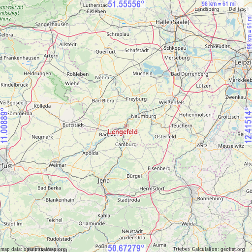
Lengefeld GPS coordinates[2]
51° 6' 58.608" North, 11° 42' 43.236" East
| Map corner | latitude | longitude |
|---|---|---|
| Upper-left | 51.55556°, | 11.00889° |
| Center: | 51.11628°, | 11.71201° |
| Lower-right: | 50.67279°, | 12.41514° |
| Map W x H: | 98.2×98.2 km | = 61×61mi |
| max Lat: | 55.01917° ⇑39.9% North |
| Lengefeld: | 51.11628° |
| min Lat: | ⇓60.1% South 47.40724° |
| min Long | Lengefeld | max Long |
| 5.92978° | 11.71201° | 14.98853° |
| W 77.4%⇐ | ⇒22.6% E |
Elevation
Elevation of Lengefeld is 133 m = 436 ft, and this is 116.1 m = 381 ft below average elevation for this country.
| Max E: |
1256 m = 4121 ft | 62.9% |
| Avg. | 249.1 m = 817 ft | |
| Lengefeld | 133 m = 436 ft | |
Min E: |
-5 m = -16 ft | 37.1% |
See also: Germany elevation on elevation.city.
Geographical zone
Lengefeld is located in North temperate zone (between Tropic of Cancer and the Arctic Circle). Distance of this North polar circle is 1717.6 km =1067.3 mi to North.| Distance of | km | miles | from Lengefeld |
|---|---|---|---|
| North Pole | 4323.5 | 2686.5 | to North |
| Arctic Circle | 1717.6 | 1067.3 | to North |
| Tropic Cancer | 3077.7 | 1912.4 | to South |
| Equator | 5683.6 | 3531.6 | to South |


Nearby cities:
15 places around Lengefeld: (largest is in red/bold)
• Bad Kösen
2.1 km =1.3 mi,  19°
19°
• Bad Sulza
6.8 km =4.2 mi,  243°
243°
• Balgstädt
10 km =6.2 mi,  8°
8°
• Camburg
6.8 km =4.2 mi,  181°
181°
• Eberstedt
10.4 km =6.5 mi, 243°
• Großheringen
3.4 km =2.1 mi, 244°
• Klosterhäseler
8.7 km =5.4 mi,  306°
306°
• Mertendorf
10.2 km =6.3 mi,  88°
88°
• Molau
8 km =5 mi,  144°
144°
• Naumburg
7.8 km =4.8 mi,  61°
61°
• Schmiedehausen
6.4 km =4 mi,  209°
209°
• Taugwitz
5.4 km =3.4 mi,  280°
280°
• Thierschneck
10 km =6.2 mi,  157°
157°
• Wethau
10.4 km =6.5 mi,  77°
77°
• Wichmar
9.4 km =5.8 mi,  192°
192°
Sources, notices
• [Note1] Compared only with cities in Germany existing in our database
• [Src1] Map data: © OpenStreetMap contributors (CC-BY-SA)
• [Src2] Other city data from geonames.org with taken over terms of usage.
• [Src3] Geographical zone / Annual Mean Temperature by Robert A. Rohde @ Wikipedia
