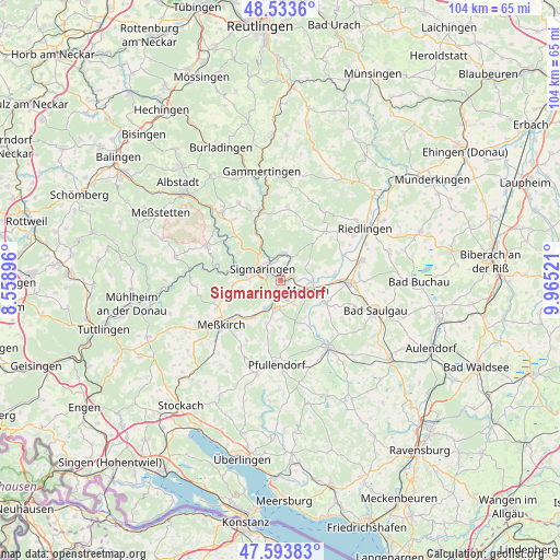
Sigmaringendorf geodata
Sigmaringendorf (Baden-Württemberg) is a seat of a fourth-order administrative division; located in Germany in Europe/Berlin (GMT+2) time zone. With population of 3,827 people, there are 3392 cities with bigger population in this country. Compared to other cities in Germany, 94.6% of cities are located further ↑North; 61.3% of cities are located further →East and 93.6% of cities have lower elevation than Sigmaringendorf. Note1
Administrative division(s):
- Level 1: Baden-Württemberg
- Level 2: Tübingen Region
- Level 3: Landkreis Sigmaringen
- Level 4: Sigmaringendorf


Sigmaringendorf GPS coordinates[2]
48° 3' 57.096" North, 9° 15' 43.488" East
| Map corner | latitude | longitude |
|---|---|---|
| Upper-left | 48.5336°, | 8.55896° |
| Center: | 48.06586°, | 9.26208° |
| Lower-right: | 47.59383°, | 9.96521° |
| Map W x H: | 104.5×104.5 km | = 64.9×64.9mi |
| max Lat: | 55.01917° ⇑94.6% North |
| Sigmaringendorf: | 48.06586° |
| min Lat: | ⇓5.4% South 47.40724° |
| min Long | Sigmaringendorf | max Long |
| 5.92978° | 9.26208° | 14.98853° |
| W 38.7%⇐ | ⇒61.3% E |
Elevation
Elevation of Sigmaringendorf is 568 m = 1864 ft, and this is 318.9 m = 1046 ft above average elevation for this country.
| Max E: |
1256 m = 4121 ft | 6.4% |
| Sigmaringendorf | 568 m 1864 ft | |
| Avg. | 249.1 m = 817 ft | |
Min E: |
-5 m = -16 ft | 93.6% |
See also: Germany elevation on elevation.city.
Geographical zone
Sigmaringendorf is located in North temperate zone (between Tropic of Cancer and the Arctic Circle). Distance of this North polar circle is 2056.8 km =1278 mi to North.| Distance of | km | miles | from Sigmaringendorf |
|---|---|---|---|
| North Pole | 4662.6 | 2897.2 | to North |
| Arctic Circle | 2056.8 | 1278 | to North |
| Tropic Cancer | 2738.5 | 1701.6 | to South |
| Equator | 5344.4 | 3320.9 | to South |


Nearby cities:
15 places around Sigmaringendorf: (largest is in red/bold)
• Bingen
5.1 km =3.2 mi,  8°
8°
• Ennetach
4.6 km =2.9 mi,  109°
109°
• Ertingen
15.7 km =9.8 mi,  75°
75°
• Herbertingen
12.7 km =7.9 mi,  89°
89°
• Hohentengen
9.5 km =5.9 mi,  115°
115°
• Inzigkofen
6.1 km =3.8 mi,  274°
274°
• Krauchenwies
5.6 km =3.5 mi,  191°
191°
• Langenenslingen
12.6 km =7.8 mi,  43°
43°
• Mengen
5.4 km =3.4 mi, 109°
• Meßkirch
13.5 km =8.4 mi,  234°
234°
• Pfullendorf
15.5 km =9.6 mi,  181°
181°
• Scheer
2.6 km =1.6 mi,  72°
72°
• Sigmaringen
3.4 km =2.1 mi,  316°
316°
• Stetten am Kalten Markt
15.1 km =9.4 mi,  295°
295°
• Veringenstadt
13.8 km =8.6 mi,  343°
343°
Sources, notices
• [Note1] Compared only with cities in Germany existing in our database
• [Src1] Map data: © OpenStreetMap contributors (CC-BY-SA)
• [Src2] Other city data from geonames.org with taken over terms of usage.
• [Src3] Geographical zone / Annual Mean Temperature by Robert A. Rohde @ Wikipedia
