Massing geodata
Massing (Bavaria) is a populated place; located in Germany in Europe/Berlin (GMT+2) time zone. With population of 4,144 people, there are 3200 cities with bigger population in this country. Compared to other cities in Germany, 90.3% of cities are located further ↑North; 89% of cities are located further ←West and 79.3% of cities have lower elevation than Massing. Note1
Administrative division(s):
- Level 1: Bavaria
- Level 2: Lower Bavaria
- Level 3: Landkreis Rottal-Inn
- Level 4: Massing, Markt


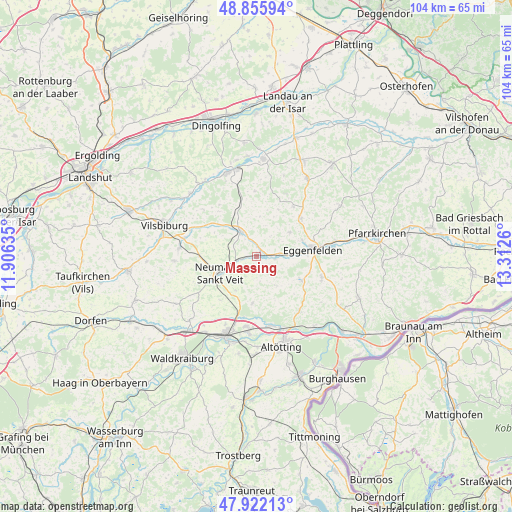
Massing GPS coordinates[2]
48° 23' 28.248" North, 12° 36' 34.092" East
| Map corner | latitude | longitude |
|---|---|---|
| Upper-left | 48.85594°, | 11.90635° |
| Center: | 48.39118°, | 12.60947° |
| Lower-right: | 47.92213°, | 13.3126° |
| Map W x H: | 103.8×103.8 km | = 64.5×64.5mi |
| max Lat: | 55.01917° ⇑90.3% North |
| Massing: | 48.39118° |
| min Lat: | ⇓9.7% South 47.40724° |
| min Long | Massing | max Long |
| 5.92978° | 12.60947° | 14.98853° |
| W 89%⇐ | ⇒11% E |
Elevation
Elevation of Massing is 429 m = 1407 ft, and this is 179.9 m = 590 ft above average elevation for this country.
| Max E: |
1256 m = 4121 ft | 20.7% |
| Massing | 429 m 1407 ft | |
| Avg. | 249.1 m = 817 ft | |
Min E: |
-5 m = -16 ft | 79.3% |
See also: Germany elevation on elevation.city.
Geographical zone
Massing is located in North temperate zone (between Tropic of Cancer and the Arctic Circle). Distance of this North polar circle is 2020.6 km =1255.5 mi to North.| Distance of | km | miles | from Massing |
|---|---|---|---|
| North Pole | 4626.5 | 2874.8 | to North |
| Arctic Circle | 2020.6 | 1255.5 | to North |
| Tropic Cancer | 2774.7 | 1724.1 | to South |
| Equator | 5380.6 | 3343.3 | to South |


Nearby cities:
15 places around Massing: (largest is in red/bold)
• Aresing
12.7 km =7.9 mi,  181°
181°
• Eggenfelden
11 km =6.8 mi,  81°
81°
• Egglkofen
11.8 km =7.3 mi,  274°
274°
• Erharting
12.1 km =7.5 mi,  189°
189°
• Falkenberg
11.9 km =7.4 mi,  48°
48°
• Gangkofen
6.1 km =3.8 mi,  326°
326°
• Geratskirchen
7 km =4.3 mi,  146°
146°
• Mitterskirchen
10.2 km =6.3 mi,  116°
116°
• Neumarkt-Sankt Veit
8.3 km =5.2 mi,  245°
245°
• Niederbergkirchen
11.6 km =7.2 mi,  224°
224°
• Niedertaufkirchen
7.8 km =4.8 mi,  214°
214°
• Pleiskirchen
9.4 km =5.8 mi, 185°
• Rimbach
8.9 km =5.5 mi,  19°
19°
• Rohrbach
12 km =7.5 mi,  199°
199°
• Unterdietfurt
4.3 km =2.7 mi,  101°
101°
Sources, notices
• [Note1] Compared only with cities in Germany existing in our database
• [Src1] Map data: © OpenStreetMap contributors (CC-BY-SA)
• [Src2] Other city data from geonames.org with taken over terms of usage.
• [Src3] Geographical zone / Annual Mean Temperature by Robert A. Rohde @ Wikipedia
