Gangkofen geodata
Gangkofen (Bavaria) is a populated place; located in Germany in Europe/Berlin (GMT+2) time zone. With population of 6,638 people, there are 2268 cities with bigger population in this country. Compared to other cities in Germany, 89.8% of cities are located further ↑North; 88.5% of cities are located further ←West and 81.7% of cities have lower elevation than Gangkofen. Note1
Administrative division(s):
- Level 1: Bavaria
- Level 2: Lower Bavaria
- Level 3: Landkreis Rottal-Inn
- Level 4: Gangkofen, Markt


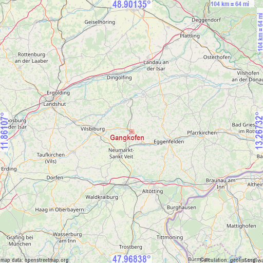
Gangkofen GPS coordinates[2]
48° 26' 13.236" North, 12° 33' 51.084" East
| Map corner | latitude | longitude |
|---|---|---|
| Upper-left | 48.90135°, | 11.86107° |
| Center: | 48.43701°, | 12.56419° |
| Lower-right: | 47.96838°, | 13.26732° |
| Map W x H: | 103.7×103.7 km | = 64.4×64.4mi |
| max Lat: | 55.01917° ⇑89.8% North |
| Gangkofen: | 48.43701° |
| min Lat: | ⇓10.2% South 47.40724° |
| min Long | Gangkofen | max Long |
| 5.92978° | 12.56419° | 14.98853° |
| W 88.5%⇐ | ⇒11.5% E |
Elevation
Elevation of Gangkofen is 444 m = 1457 ft, and this is 194.9 m = 639 ft above average elevation for this country.
| Max E: |
1256 m = 4121 ft | 18.3% |
| Gangkofen | 444 m 1457 ft | |
| Avg. | 249.1 m = 817 ft | |
Min E: |
-5 m = -16 ft | 81.7% |
See also: Germany elevation on elevation.city.
Geographical zone
Gangkofen is located in North temperate zone (between Tropic of Cancer and the Arctic Circle). Distance of this North polar circle is 2015.5 km =1252.4 mi to North.| Distance of | km | miles | from Gangkofen |
|---|---|---|---|
| North Pole | 4621.4 | 2871.6 | to North |
| Arctic Circle | 2015.5 | 1252.4 | to North |
| Tropic Cancer | 2779.8 | 1727.3 | to South |
| Equator | 5385.7 | 3346.5 | to South |


Nearby cities:
15 places around Gangkofen: (largest is in red/bold)
• Aham
12.5 km =7.8 mi,  322°
322°
• Egglkofen
9.4 km =5.8 mi,  243°
243°
• Falkenberg
12.6 km =7.8 mi,  77°
77°
• Frontenhausen
12.4 km =7.7 mi,  348°
348°
• Furth
13.9 km =8.6 mi,  255°
255°
• Geratskirchen
13.1 km =8.1 mi,  146°
146°
• Gerzen
12.8 km =8 mi,  307°
307°
• Marklkofen
12.6 km =7.8 mi,  0°
0°
• Massing
6.1 km =3.8 mi, 146°
• Neumarkt-Sankt Veit
9.5 km =5.9 mi,  206°
206°
• Niederbergkirchen
14.2 km =8.8 mi,  199°
199°
• Niedertaufkirchen
11.6 km =7.2 mi,  185°
185°
• Rimbach
7.1 km =4.4 mi,  62°
62°
• Schalkham
12 km =7.5 mi,  295°
295°
• Unterdietfurt
9.6 km =6 mi,  128°
128°
Sources, notices
• [Note1] Compared only with cities in Germany existing in our database
• [Src1] Map data: © OpenStreetMap contributors (CC-BY-SA)
• [Src2] Other city data from geonames.org with taken over terms of usage.
• [Src3] Geographical zone / Annual Mean Temperature by Robert A. Rohde @ Wikipedia
