Marktleuthen geodata
Marktleuthen (Bavaria) is a populated place; located in Germany in Europe/Berlin (GMT+2) time zone. With population of 3,673 people, there are 3496 cities with bigger population in this country. Compared to other cities in Germany, 60.7% of cities are located further ↑North; 81.8% of cities are located further ←West and 90.8% of cities have lower elevation than Marktleuthen. Note1
Administrative division(s):
- Level 1: Bavaria
- Level 2: Upper Franconia
- Level 3: Landkreis Wunsiedel im Fichtelgebirge
- Level 4: Marktleuthen


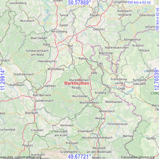
Marktleuthen GPS coordinates[2]
50° 7' 48.252" North, 12° 0' 8.136" East
| Map corner | latitude | longitude |
|---|---|---|
| Upper-left | 50.57869°, | 11.29914° |
| Center: | 50.13007°, | 12.00226° |
| Lower-right: | 49.67721°, | 12.70539° |
| Map W x H: | 100.2×100.2 km | = 62.3×62.3mi |
| max Lat: | 55.01917° ⇑60.7% North |
| Marktleuthen: | 50.13007° |
| min Lat: | ⇓39.3% South 47.40724° |
| min Long | Marktleuthen | max Long |
| 5.92978° | 12.00226° | 14.98853° |
| W 81.8%⇐ | ⇒18.2% E |
Elevation
Elevation of Marktleuthen is 525 m = 1722 ft, and this is 275.9 m = 905 ft above average elevation for this country.
| Max E: |
1256 m = 4121 ft | 9.2% |
| Marktleuthen | 525 m 1722 ft | |
| Avg. | 249.1 m = 817 ft | |
Min E: |
-5 m = -16 ft | 90.8% |
See also: Germany elevation on elevation.city.
Geographical zone
Marktleuthen is located in North temperate zone (between Tropic of Cancer and the Arctic Circle). Distance of this North polar circle is 1827.2 km =1135.4 mi to North.| Distance of | km | miles | from Marktleuthen |
|---|---|---|---|
| North Pole | 4433.1 | 2754.6 | to North |
| Arctic Circle | 1827.2 | 1135.4 | to North |
| Tropic Cancer | 2968 | 1844.2 | to South |
| Equator | 5573.9 | 3463.5 | to South |


Nearby cities:
15 places around Marktleuthen: (largest is in red/bold)
• Bad Alexandersbad
12.7 km =7.9 mi,  175°
175°
• Grub
6 km =3.7 mi,  239°
239°
• Höchstädt bei Thiersheim
6.8 km =4.2 mi,  117°
117°
• Kirchenlamitz
4.5 km =2.8 mi,  302°
302°
• Röslau
5.4 km =3.4 mi,  194°
194°
• Schwarzenbach an der Saale
11.4 km =7.1 mi,  335°
335°
• Schönwald
9.7 km =6 mi,  37°
37°
• Selb
10.2 km =6.3 mi,  63°
63°
• Sparneck
11.9 km =7.4 mi,  287°
287°
• Thiersheim
10.7 km =6.6 mi, 124°
• Thierstein
7.6 km =4.7 mi,  110°
110°
• Weißdorf
12.4 km =7.7 mi, 298°
• Weißenstadt
8.7 km =5.4 mi,  249°
249°
• Wunsiedel
10.1 km =6.3 mi, 179°
• Zell im Fichtelgebirge
12.8 km =8 mi,  272°
272°
Sources, notices
• [Note1] Compared only with cities in Germany existing in our database
• [Src1] Map data: © OpenStreetMap contributors (CC-BY-SA)
• [Src2] Other city data from geonames.org with taken over terms of usage.
• [Src3] Geographical zone / Annual Mean Temperature by Robert A. Rohde @ Wikipedia
