Lossa geodata
Lossa (Saxony-Anhalt) is a populated place; located in Germany in Europe/Berlin (GMT+2) time zone. With population of 856 people, there are 7682 cities with bigger population in this country. Compared to other cities in Germany, 61.9% of cities are located further ↓South; 72.8% of cities are located further ←West and 62.5% of cities have lower elevation than Lossa. Note1


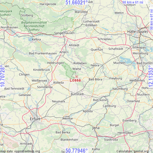
Lossa GPS coordinates[2]
51° 13' 18.984" North, 11° 24' 37.44" East
| Map corner | latitude | longitude |
|---|---|---|
| Upper-left | 51.66021°, | 10.70728° |
| Center: | 51.22194°, | 11.4104° |
| Lower-right: | 50.77946°, | 12.11353° |
| Map W x H: | 97.9×97.9 km | = 60.8×60.8mi |
| max Lat: | 55.01917° ⇑38.1% North |
| Lossa: | 51.22194° |
| min Lat: | ⇓61.9% South 47.40724° |
| min Long | Lossa | max Long |
| 5.92978° | 11.4104° | 14.98853° |
| W 72.8%⇐ | ⇒27.2% E |
Elevation
Elevation of Lossa is 305 m = 1001 ft, and this is 55.9 m = 183 ft above average elevation for this country.
| Max E: |
1256 m = 4121 ft | 37.5% |
| Lossa | 305 m 1001 ft | |
| Avg. | 249.1 m = 817 ft | |
Min E: |
-5 m = -16 ft | 62.5% |
See also: Germany elevation on elevation.city.
Geographical zone
Lossa is located in North temperate zone (between Tropic of Cancer and the Arctic Circle). Distance of this North polar circle is 1705.8 km =1059.9 mi to North.| Distance of | km | miles | from Lossa |
|---|---|---|---|
| North Pole | 4311.7 | 2679.2 | to North |
| Arctic Circle | 1705.8 | 1059.9 | to North |
| Tropic Cancer | 3089.4 | 1919.7 | to South |
| Equator | 5695.3 | 3538.9 | to South |


Nearby cities:
15 places around Lossa: (largest is in red/bold)
• Billroda
4 km =2.5 mi,  127°
127°
• Donndorf
8.4 km =5.2 mi,  341°
341°
• Großmonra
8 km =5 mi,  262°
262°
• Hardisleben
7.7 km =4.8 mi,  172°
172°
• Hauteroda
10.1 km =6.3 mi,  299°
299°
• Herrengosserstedt
10 km =6.2 mi,  152°
152°
• Mannstedt
10 km =6.2 mi,  190°
190°
• Memleben
7.5 km =4.7 mi,  49°
49°
• Olbersleben
9.6 km =6 mi,  213°
213°
• Ostramondra
5.9 km =3.7 mi,  245°
245°
• Rastenberg
5.3 km =3.3 mi, 172°
• Roßleben
8.7 km =5.4 mi,  11°
11°
• Saubach
8 km =5 mi,  95°
95°
• Wiehe
4.9 km =3 mi,  1°
1°
• Wohlmirstedt
4.6 km =2.9 mi, 51°
Sources, notices
• [Note1] Compared only with cities in Germany existing in our database
• [Src1] Map data: © OpenStreetMap contributors (CC-BY-SA)
• [Src2] Other city data from geonames.org with taken over terms of usage.
• [Src3] Geographical zone / Annual Mean Temperature by Robert A. Rohde @ Wikipedia
