Longkamp geodata
Longkamp (Rheinland-Pfalz) is a seat of a fourth-order administrative division; located in Germany in Europe/Berlin (GMT+2) time zone. With population of 1,182 people, there are 6612 cities with bigger population in this country. Compared to other cities in Germany, 66.7% of cities are located further ↑North; 92.2% of cities are located further →East and 76.5% of cities have lower elevation than Longkamp. Note1
Administrative division(s):
- Level 1: Rheinland-Pfalz
- Level 3: Landkreis Bernkastel-Wittlich
- Level 4: Longkamp


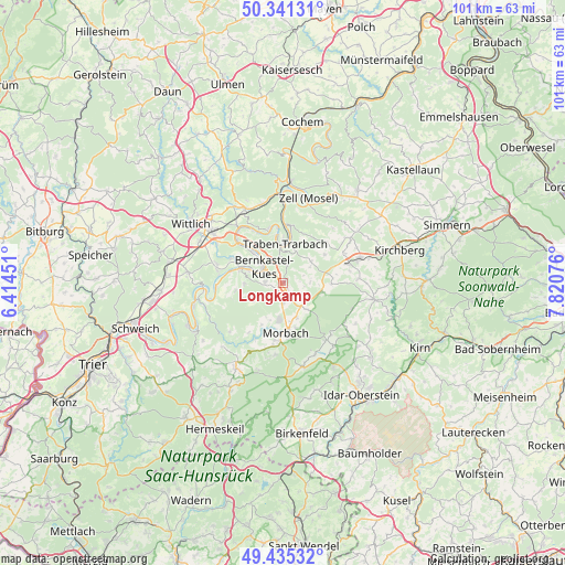
Longkamp GPS coordinates[2]
49° 53' 25.584" North, 7° 7' 3.504" East
| Map corner | latitude | longitude |
|---|---|---|
| Upper-left | 50.34131°, | 6.41451° |
| Center: | 49.89044°, | 7.11764° |
| Lower-right: | 49.43532°, | 7.82076° |
| Map W x H: | 100.7×100.7 km | = 62.6×62.6mi |
| max Lat: | 55.01917° ⇑66.7% North |
| Longkamp: | 49.89044° |
| min Lat: | ⇓33.3% South 47.40724° |
| min Long | Longkamp | max Long |
| 5.92978° | 7.11764° | 14.98853° |
| W 7.8%⇐ | ⇒92.2% E |
Elevation
Elevation of Longkamp is 409 m = 1342 ft, and this is 159.9 m = 525 ft above average elevation for this country.
| Max E: |
1256 m = 4121 ft | 23.5% |
| Longkamp | 409 m 1342 ft | |
| Avg. | 249.1 m = 817 ft | |
Min E: |
-5 m = -16 ft | 76.5% |
See also: Germany elevation on elevation.city.
Geographical zone
Longkamp is located in North temperate zone (between Tropic of Cancer and the Arctic Circle). Distance of this North polar circle is 1853.9 km =1152 mi to North.| Distance of | km | miles | from Longkamp |
|---|---|---|---|
| North Pole | 4459.8 | 2771.2 | to North |
| Arctic Circle | 1853.9 | 1152 | to North |
| Tropic Cancer | 2941.4 | 1827.7 | to South |
| Equator | 5547.3 | 3446.9 | to South |


Nearby cities:
15 places around Longkamp: (largest is in red/bold)
• Bernkastel-Kues
4.1 km =2.5 mi,  314°
314°
• Burgen
8.5 km =5.3 mi,  264°
264°
• Gornhausen
5.5 km =3.4 mi,  241°
241°
• Graach
6.3 km =3.9 mi,  321°
321°
• Hochscheid
7.1 km =4.4 mi,  96°
96°
• Horbruch
8.3 km =5.2 mi, 95°
• Irmenach
6.3 km =3.9 mi,  53°
53°
• Kleinich
4.8 km =3 mi,  77°
77°
• Kommen
1.4 km =0.9 mi,  125°
125°
• Lieser
7.8 km =4.8 mi,  291°
291°
• Lötzbeuren
8.5 km =5.3 mi,  56°
56°
• Monzelfeld
3.2 km =2 mi,  273°
273°
• Mülheim
7.4 km =4.6 mi, 289°
• Traben-Trarbach
6.7 km =4.2 mi,  358°
358°
• Veldenz
6.8 km =4.2 mi, 268°
Sources, notices
• [Note1] Compared only with cities in Germany existing in our database
• [Src1] Map data: © OpenStreetMap contributors (CC-BY-SA)
• [Src2] Other city data from geonames.org with taken over terms of usage.
• [Src3] Geographical zone / Annual Mean Temperature by Robert A. Rohde @ Wikipedia
