Lichtenberg geodata
Lichtenberg (Bavaria) is a populated place; located in Germany in Europe/Berlin (GMT+2) time zone. With population of 1,184 people, there are 6607 cities with bigger population in this country. Compared to other cities in Germany, 54.9% of cities are located further ↑North; 76.9% of cities are located further ←West and 93.2% of cities have lower elevation than Lichtenberg. Note1
Administrative division(s):
- Level 1: Bavaria
- Level 2: Upper Franconia
- Level 3: Landkreis Hof
- Level 4: Lichtenberg


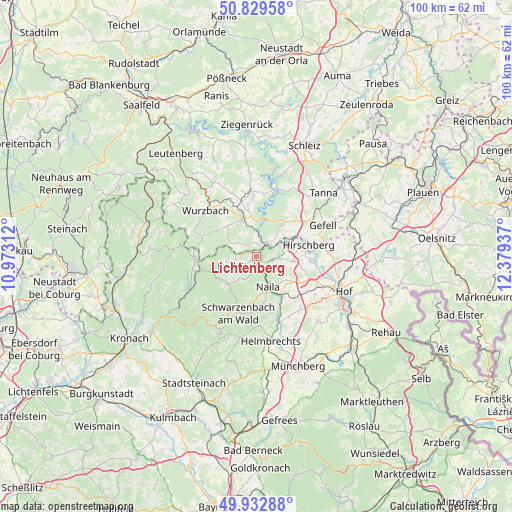
Lichtenberg GPS coordinates[2]
50° 23' 0.06" North, 11° 40' 34.464" East
| Map corner | latitude | longitude |
|---|---|---|
| Upper-left | 50.82958°, | 10.97312° |
| Center: | 50.38335°, | 11.67624° |
| Lower-right: | 49.93288°, | 12.37937° |
| Map W x H: | 99.7×99.7 km | = 62×62mi |
| max Lat: | 55.01917° ⇑54.9% North |
| Lichtenberg: | 50.38335° |
| min Lat: | ⇓45.1% South 47.40724° |
| min Long | Lichtenberg | max Long |
| 5.92978° | 11.67624° | 14.98853° |
| W 76.9%⇐ | ⇒23.1% E |
Elevation
Elevation of Lichtenberg is 561 m = 1841 ft, and this is 311.9 m = 1023 ft above average elevation for this country.
| Max E: |
1256 m = 4121 ft | 6.8% |
| Lichtenberg | 561 m 1841 ft | |
| Avg. | 249.1 m = 817 ft | |
Min E: |
-5 m = -16 ft | 93.2% |
See also: Germany elevation on elevation.city.
Geographical zone
Lichtenberg is located in North temperate zone (between Tropic of Cancer and the Arctic Circle). Distance of this North polar circle is 1799.1 km =1117.9 mi to North.| Distance of | km | miles | from Lichtenberg |
|---|---|---|---|
| North Pole | 4405 | 2737.1 | to North |
| Arctic Circle | 1799.1 | 1117.9 | to North |
| Tropic Cancer | 2996.2 | 1861.8 | to South |
| Equator | 5602.1 | 3481 | to South |


Nearby cities:
15 places around Lichtenberg: (largest is in red/bold)
• Bad Lobenstein
8.1 km =5 mi,  341°
341°
• Bad Steben
2.9 km =1.8 mi,  230°
230°
• Berg
7.3 km =4.5 mi,  97°
97°
• Birkenhügel
7.6 km =4.7 mi,  43°
43°
• Blankenberg
3.6 km =2.2 mi,  52°
52°
• Blankenstein
2.6 km =1.6 mi, 37°
• Geroldsgrün
7.8 km =4.8 mi,  224°
224°
• Harra
3.7 km =2.3 mi,  7°
7°
• Issigau
3.3 km =2.1 mi,  105°
105°
• Naila
6.2 km =3.9 mi,  161°
161°
• Nordhalben
11.8 km =7.3 mi,  265°
265°
• Pottiga
5.7 km =3.5 mi, 52°
• Schauenstein
12.6 km =7.8 mi, 158°
• Schlegel
4.6 km =2.9 mi,  293°
293°
• Selbitz
9.1 km =5.7 mi,  144°
144°
Sources, notices
• [Note1] Compared only with cities in Germany existing in our database
• [Src1] Map data: © OpenStreetMap contributors (CC-BY-SA)
• [Src2] Other city data from geonames.org with taken over terms of usage.
• [Src3] Geographical zone / Annual Mean Temperature by Robert A. Rohde @ Wikipedia
