Harra geodata
Harra (Thuringia) is a seat of a fourth-order administrative division; located in Germany in Europe/Berlin (GMT+2) time zone. In our database, there are 11009 cities with bigger population. Compared to other cities in Germany, 54.4% of cities are located further ↑North; 76.9% of cities are located further ←West and 84.5% of cities have lower elevation than Harra. Note1
Administrative division(s):
- Level 1: Thuringia
- Level 3: Saale-Orla-Kreis
- Level 4: Rosenthal am Rennsteig


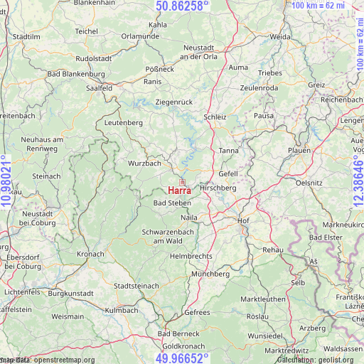
Harra GPS coordinates[2]
50° 25' 0.012" North, 11° 40' 59.988" East
| Map corner | latitude | longitude |
|---|---|---|
| Upper-left | 50.86258°, | 10.98021° |
| Center: | 50.41667°, | 11.68333° |
| Lower-right: | 49.96652°, | 12.38646° |
| Map W x H: | 99.6×99.6 km | = 61.9×61.9mi |
| max Lat: | 55.01917° ⇑54.4% North |
| Harra: | 50.41667° |
| min Lat: | ⇓45.6% South 47.40724° |
| min Long | Harra | max Long |
| 5.92978° | 11.68333° | 14.98853° |
| W 76.9%⇐ | ⇒23.1% E |
Elevation
Elevation of Harra is 465 m = 1526 ft, and this is 215.9 m = 708 ft above average elevation for this country.
| Max E: |
1256 m = 4121 ft | 15.5% |
| Harra | 465 m 1526 ft | |
| Avg. | 249.1 m = 817 ft | |
Min E: |
-5 m = -16 ft | 84.5% |
See also: Germany elevation on elevation.city.
Geographical zone
Harra is located in North temperate zone (between Tropic of Cancer and the Arctic Circle). Distance of this North polar circle is 1795.4 km =1115.6 mi to North.| Distance of | km | miles | from Harra |
|---|---|---|---|
| North Pole | 4401.3 | 2734.8 | to North |
| Arctic Circle | 1795.4 | 1115.6 | to North |
| Tropic Cancer | 2999.9 | 1864.1 | to South |
| Equator | 5605.8 | 3483.3 | to South |


Nearby cities:
15 places around Harra: (largest is in red/bold)
• Bad Lobenstein
5 km =3.1 mi,  321°
321°
• Bad Steben
6.2 km =3.9 mi,  206°
206°
• Berg
8.2 km =5.1 mi,  124°
124°
• Birkenhügel
5.1 km =3.2 mi,  68°
68°
• Blankenberg
2.8 km =1.7 mi, 123°
• Blankenstein
2 km =1.2 mi,  145°
145°
• Geroldsgrün
11 km =6.8 mi, 212°
• Issigau
5.3 km =3.3 mi, 150°
• Lichtenberg
3.7 km =2.3 mi,  187°
187°
• Naila
9.7 km =6 mi,  171°
171°
• Nordhalben
13.2 km =8.2 mi,  248°
248°
• Pottiga
4.1 km =2.5 mi,  93°
93°
• Schlegel
5.1 km =3.2 mi, 248°
• Selbitz
12.1 km =7.5 mi,  156°
156°
• Wurzbach
11.6 km =7.2 mi,  296°
296°
Sources, notices
• [Note1] Compared only with cities in Germany existing in our database
• [Src1] Map data: © OpenStreetMap contributors (CC-BY-SA)
• [Src2] Other city data from geonames.org with taken over terms of usage.
• [Src3] Geographical zone / Annual Mean Temperature by Robert A. Rohde @ Wikipedia
