Leubsdorf geodata
Leubsdorf (Saxony) is a seat of a fourth-order administrative division; located in Germany in Europe/Berlin (GMT+2) time zone. With population of 3,981 people, there are 3314 cities with bigger population in this country. Compared to other cities in Germany, 54.1% of cities are located further ↓South; 93.4% of cities are located further ←West and 76.2% of cities have lower elevation than Leubsdorf. Note1


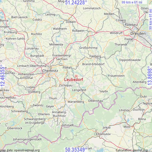
Leubsdorf GPS coordinates[2]
50° 48' 0" North, 13° 10' 0.012" East
| Map corner | latitude | longitude |
|---|---|---|
| Upper-left | 51.24228°, | 12.46355° |
| Center: | 50.8°, | 13.16667° |
| Lower-right: | 50.35349°, | 13.8698° |
| Map W x H: | 98.8×98.8 km | = 61.4×61.4mi |
| max Lat: | 55.01917° ⇑45.9% North |
| Leubsdorf: | 50.8° |
| min Lat: | ⇓54.1% South 47.40724° |
| min Long | Leubsdorf | max Long |
| 5.92978° | 13.16667° | 14.98853° |
| W 93.4%⇐ | ⇒6.6% E |
Elevation
Elevation of Leubsdorf is 407 m = 1335 ft, and this is 157.9 m = 518 ft above average elevation for this country.
| Max E: |
1256 m = 4121 ft | 23.8% |
| Leubsdorf | 407 m 1335 ft | |
| Avg. | 249.1 m = 817 ft | |
Min E: |
-5 m = -16 ft | 76.2% |
See also: Germany elevation on elevation.city.
Geographical zone
Leubsdorf is located in North temperate zone (between Tropic of Cancer and the Arctic Circle). Distance of this North polar circle is 1752.7 km =1089.1 mi to North.| Distance of | km | miles | from Leubsdorf |
|---|---|---|---|
| North Pole | 4358.6 | 2708.3 | to North |
| Arctic Circle | 1752.7 | 1089.1 | to North |
| Tropic Cancer | 3042.5 | 1890.5 | to South |
| Equator | 5648.4 | 3509.8 | to South |


Nearby cities:
15 places around Leubsdorf: (largest is in red/bold)
• Augustusburg
4.7 km =2.9 mi,  286°
286°
• Borstendorf
3.1 km =1.9 mi,  163°
163°
• Börnichen
5.8 km =3.6 mi,  198°
198°
• Eppendorf
4.7 km =2.9 mi,  90°
90°
• Falkenau
7.1 km =4.4 mi,  330°
330°
• Flöha
9 km =5.6 mi,  313°
313°
• Frankenstein
11.6 km =7.2 mi,  14°
14°
• Gahlenz
4.2 km =2.6 mi,  47°
47°
• Gornau
10.2 km =6.3 mi,  243°
243°
• Großhartmannsdorf
11.7 km =7.3 mi, 90°
• Grünhainichen
3.8 km =2.4 mi,  194°
194°
• Lengefeld
9.2 km =5.7 mi,  168°
168°
• Oederan
6.8 km =4.2 mi,  2°
2°
• Pockau
12.1 km =7.5 mi, 157°
• Zschopau
8.5 km =5.3 mi,  227°
227°
Sources, notices
• [Note1] Compared only with cities in Germany existing in our database
• [Src1] Map data: © OpenStreetMap contributors (CC-BY-SA)
• [Src2] Other city data from geonames.org with taken over terms of usage.
• [Src3] Geographical zone / Annual Mean Temperature by Robert A. Rohde @ Wikipedia
