Lengenfeld geodata
Lengenfeld (Saxony) is a populated place; located in Germany in Europe/Berlin (GMT+2) time zone. With population of 8,141 people, there are 1938 cities with bigger population in this country. Compared to other cities in Germany, 51.2% of cities are located further ↑North; 86.6% of cities are located further ←West and 74.4% of cities have lower elevation than Lengenfeld. Note1


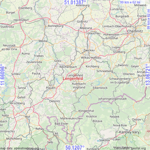
Lengenfeld GPS coordinates[2]
50° 34' 9.84" North, 12° 21' 50.688" East
| Map corner | latitude | longitude |
|---|---|---|
| Upper-left | 51.01387°, | 11.66096° |
| Center: | 50.5694°, | 12.36408° |
| Lower-right: | 50.1207°, | 13.06721° |
| Map W x H: | 99.3×99.3 km | = 61.7×61.7mi |
| max Lat: | 55.01917° ⇑51.2% North |
| Lengenfeld: | 50.5694° |
| min Lat: | ⇓48.8% South 47.40724° |
| min Long | Lengenfeld | max Long |
| 5.92978° | 12.36408° | 14.98853° |
| W 86.6%⇐ | ⇒13.4% E |
Elevation
Elevation of Lengenfeld is 393 m = 1289 ft, and this is 143.9 m = 472 ft above average elevation for this country.
| Max E: |
1256 m = 4121 ft | 25.6% |
| Lengenfeld | 393 m 1289 ft | |
| Avg. | 249.1 m = 817 ft | |
Min E: |
-5 m = -16 ft | 74.4% |
See also: Germany elevation on elevation.city.
Geographical zone
Lengenfeld is located in North temperate zone (between Tropic of Cancer and the Arctic Circle). Distance of this North polar circle is 1778.4 km =1105 mi to North.| Distance of | km | miles | from Lengenfeld |
|---|---|---|---|
| North Pole | 4384.3 | 2724.3 | to North |
| Arctic Circle | 1778.4 | 1105 | to North |
| Tropic Cancer | 3016.9 | 1874.6 | to South |
| Equator | 5622.8 | 3493.8 | to South |


Nearby cities:
15 places around Lengenfeld: (largest is in red/bold)
• Auerbach
6.9 km =4.3 mi,  158°
158°
• Ellefeld
9.7 km =6 mi,  169°
169°
• Falkenstein
10.2 km =6.3 mi,  177°
177°
• Hirschfeld
9 km =5.6 mi,  47°
47°
• Limbach
8.2 km =5.1 mi,  280°
280°
• Mylau
8.9 km =5.5 mi,  308°
308°
• Netzschkau
9.8 km =6.1 mi,  300°
300°
• Neumark
10.1 km =6.3 mi,  356°
356°
• Neustadt Vogtland
12.3 km =7.6 mi,  190°
190°
• Reichenbach/Vogtland
7.3 km =4.5 mi,  324°
324°
• Reuth
11.7 km =7.3 mi, 296°
• Rodewisch
5.5 km =3.4 mi,  140°
140°
• Stützengrün
12.6 km =7.8 mi,  108°
108°
• Treuen
5.2 km =3.2 mi,  235°
235°
• Waldkirchen
3.2 km =2 mi,  20°
20°
Sources, notices
• [Note1] Compared only with cities in Germany existing in our database
• [Src1] Map data: © OpenStreetMap contributors (CC-BY-SA)
• [Src2] Other city data from geonames.org with taken over terms of usage.
• [Src3] Geographical zone / Annual Mean Temperature by Robert A. Rohde @ Wikipedia
