Bad Peterstal-Griesbach geodata
Bad Peterstal-Griesbach (Baden-Württemberg) is a seat of a fourth-order administrative division; located in Germany in Europe/Berlin (GMT+2) time zone. With population of 3,006 people, there are 3992 cities with bigger population in this country. Compared to other cities in Germany, 89.9% of cities are located further ↑North; 73.8% of cities are located further →East and 82% of cities have lower elevation than Bad Peterstal-Griesbach. Note1
Administrative division(s):
- Level 1: Baden-Württemberg
- Level 2: Freiburg Region
- Level 3: Ortenaukreis
- Level 4: Bad Peterstal-Griesbach
Current local time in Bad Peterstal-Griesbach:
02:39 PM, TuesdayDifference from your time zone: hours


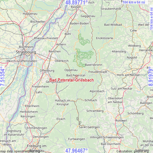
Bad Peterstal-Griesbach GPS coordinates[2]
48° 25' 59.988" North, 8° 13' 0.012" East
| Map corner | latitude | longitude |
|---|---|---|
| Upper-left | 48.89771°, | 7.51354° |
| Center: | 48.43333°, | 8.21667° |
| Lower-right: | 47.96467°, | 8.91979° |
| Map W x H: | 103.7×103.7 km | = 64.4×64.4mi |
| max Lat: | 55.01917° ⇑89.9% North |
| Bad Peterstal-Griesbach: | 48.43333° |
| min Lat: | ⇓10.1% South 47.40724° |
| min Long | Bad Peterstal-G | max Long |
| 5.92978° | 8.21667° | 14.98853° |
| W 26.2%⇐ | ⇒73.8% E |
Elevation
Elevation of Bad Peterstal-Griesbach is 446 m = 1463 ft, and this is 196.9 m = 646 ft above average elevation for this country.
| Max E: |
1256 m = 4121 ft | 18% |
| Bad Peterstal-Griesbach | 446 m 1463 ft | |
| Avg. | 249.1 m = 817 ft | |
Min E: |
-5 m = -16 ft | 82% |
See also: Germany elevation on elevation.city.
Geographical zone
Bad Peterstal-Griesbach is located in North temperate zone (between Tropic of Cancer and the Arctic Circle). Distance of this North polar circle is 2015.9 km =1252.6 mi to North.| Distance of | km | miles | from Bad Peterstal-Griesbach |
|---|---|---|---|
| North Pole | 4621.8 | 2871.9 | to North |
| Arctic Circle | 2015.9 | 1252.6 | to North |
| Tropic Cancer | 2779.4 | 1727 | to South |
| Equator | 5385.3 | 3346.3 | to South |


Nearby cities:
15 places around Bad Peterstal-Griesbach: (largest is in red/bold)
• Bad Rippoldsau-Schapbach
8.1 km =5 mi,  93°
93°
• Baiersbronn
14.1 km =8.8 mi,  56°
56°
• Durbach
16.1 km =10 mi,  294°
294°
• Freudenstadt
15 km =9.3 mi,  75°
75°
• Gengenbach
15.3 km =9.5 mi,  257°
257°
• Lautenbach
12.3 km =7.6 mi,  322°
322°
• Lautenbach
15 km =9.3 mi, 291°
• Nordrach
10.5 km =6.5 mi,  249°
249°
• Oberharmersbach
9.5 km =5.9 mi,  225°
225°
• Oberkirch
15 km =9.3 mi, 317°
• Oberwolfach
13 km =8.1 mi,  180°
180°
• Oppenau
6.1 km =3.8 mi, 316°
• Ottenhöfen im Schwarzwald
15.6 km =9.7 mi,  341°
341°
• Seebach
16.2 km =10.1 mi,  347°
347°
• Wolfach
15.6 km =9.7 mi, 180°
Sources, notices
• [Note1] Compared only with cities in Germany existing in our database
• [Src1] Map data: © OpenStreetMap contributors (CC-BY-SA)
• [Src2] Other city data from geonames.org with taken over terms of usage.
• [Src3] Geographical zone / Annual Mean Temperature by Robert A. Rohde @ Wikipedia
