Langen geodata
Langen (Lower Saxony) is a populated place; located in Germany in Europe/Berlin (GMT+2) time zone. With population of 18,863 people, there are 829 cities with bigger population in this country. Compared to other cities in Germany, 87.1% of cities are located further ↓South; 70.2% of cities are located further →East and 96.2% of cities have higher elevation than Langen. Note1


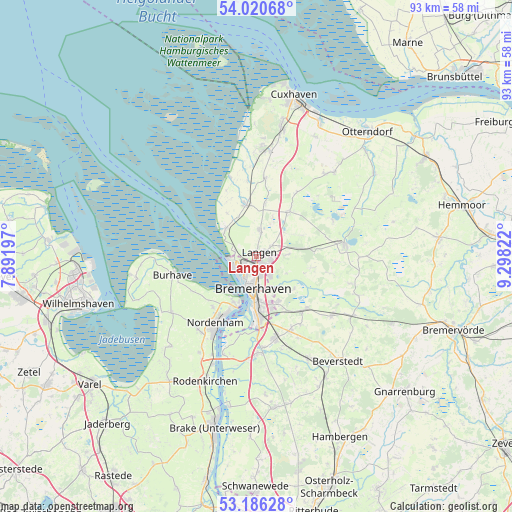
Langen GPS coordinates[2]
53° 36' 19.944" North, 8° 35' 42.324" East
| Map corner | latitude | longitude |
|---|---|---|
| Upper-left | 54.02068°, | 7.89197° |
| Center: | 53.60554°, | 8.59509° |
| Lower-right: | 53.18628°, | 9.29822° |
| Map W x H: | 92.8×92.8 km | = 57.7×57.7mi |
| max Lat: | 55.01917° ⇑12.9% North |
| Langen: | 53.60554° |
| min Lat: | ⇓87.1% South 47.40724° |
| min Long | Langen | max Long |
| 5.92978° | 8.59509° | 14.98853° |
| W 29.8%⇐ | ⇒70.2% E |
Elevation
Elevation of Langen is 6 m = 20 ft, and this is 243.1 m = 798 ft below average elevation for this country.
| Max E: |
1256 m = 4121 ft | 96.2% |
| Avg. | 249.1 m = 817 ft | |
| Langen | 6 m = 20 ft | |
Min E: |
-5 m = -16 ft | 3.8% |
See also: Germany elevation on elevation.city.
Geographical zone
Langen is located in North temperate zone (between Tropic of Cancer and the Arctic Circle). Distance of this North polar circle is 1440.8 km =895.3 mi to North.| Distance of | km | miles | from Langen |
|---|---|---|---|
| North Pole | 4046.7 | 2514.5 | to North |
| Arctic Circle | 1440.8 | 895.3 | to North |
| Tropic Cancer | 3354.5 | 2084.4 | to South |
| Equator | 5960.4 | 3703.6 | to South |


Nearby cities:
15 places around Langen: (largest is in red/bold)
• Bremerhaven
6.3 km =3.9 mi,  191°
191°
• Cappel
13.5 km =8.4 mi,  353°
353°
• Dorum
9.3 km =5.8 mi, 348°
• Drangstedt
10.6 km =6.6 mi,  85°
85°
• Elmlohe
10 km =6.2 mi,  102°
102°
• Flögeln
15.2 km =9.4 mi,  65°
65°
• Kührstedt
13.9 km =8.6 mi, 102°
• Loxstedt
15.9 km =9.9 mi,  166°
166°
• Midlum
14.1 km =8.8 mi,  5°
5°
• Misselwarden
9.3 km =5.8 mi,  326°
326°
• Mulsum
7.4 km =4.6 mi,  336°
336°
• Nordenham
15.3 km =9.5 mi,  209°
209°
• Padingbüttel
11.3 km =7 mi, 338°
• Schiffdorf
8.8 km =5.5 mi,  155°
155°
• Wremen
7.2 km =4.5 mi,  313°
313°
Sources, notices
• [Note1] Compared only with cities in Germany existing in our database
• [Src1] Map data: © OpenStreetMap contributors (CC-BY-SA)
• [Src2] Other city data from geonames.org with taken over terms of usage.
• [Src3] Geographical zone / Annual Mean Temperature by Robert A. Rohde @ Wikipedia
