Loxstedt geodata
Loxstedt (Lower Saxony) is a seat of a fourth-order administrative division; located in Germany in Europe/Berlin (GMT+2) time zone. With population of 16,382 people, there are 967 cities with bigger population in this country. Compared to other cities in Germany, 85.1% of cities are located further ↓South; 69.6% of cities are located further →East and 95.6% of cities have higher elevation than Loxstedt. Note1


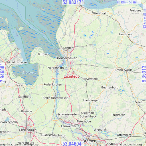
Loxstedt GPS coordinates[2]
53° 28' 0.012" North, 8° 39' 0" East
| Map corner | latitude | longitude |
|---|---|---|
| Upper-left | 53.88317°, | 7.94688° |
| Center: | 53.46667°, | 8.65° |
| Lower-right: | 53.04604°, | 9.35313° |
| Map W x H: | 93.1×93.1 km | = 57.8×57.8mi |
| max Lat: | 55.01917° ⇑14.9% North |
| Loxstedt: | 53.46667° |
| min Lat: | ⇓85.1% South 47.40724° |
| min Long | Loxstedt | max Long |
| 5.92978° | 8.65° | 14.98853° |
| W 30.4%⇐ | ⇒69.6% E |
Elevation
Elevation of Loxstedt is 7 m = 23 ft, and this is 242.1 m = 794 ft below average elevation for this country.
| Max E: |
1256 m = 4121 ft | 95.6% |
| Avg. | 249.1 m = 817 ft | |
| Loxstedt | 7 m = 23 ft | |
Min E: |
-5 m = -16 ft | 4.4% |
See also: Germany elevation on elevation.city.
Geographical zone
Loxstedt is located in North temperate zone (between Tropic of Cancer and the Arctic Circle). Distance of this North polar circle is 1456.2 km =904.8 mi to North.| Distance of | km | miles | from Loxstedt |
|---|---|---|---|
| North Pole | 4062.1 | 2524.1 | to North |
| Arctic Circle | 1456.2 | 904.8 | to North |
| Tropic Cancer | 3339 | 2074.8 | to South |
| Equator | 5944.9 | 3694 | to South |


Nearby cities:
15 places around Loxstedt: (largest is in red/bold)
• Axstedt
15 km =9.3 mi,  146°
146°
• Beverstedt
11.8 km =7.3 mi,  107°
107°
• Bokel
11.3 km =7 mi,  136°
136°
• Bramstedt
11.5 km =7.1 mi,  166°
166°
• Bremerhaven
10.5 km =6.5 mi,  332°
332°
• Driftsethe
9.5 km =5.9 mi,  193°
193°
• Elmlohe
14.7 km =9.1 mi,  24°
24°
• Hagen im Bremischen
12.2 km =7.6 mi,  182°
182°
• Heerstedt
7.2 km =4.5 mi,  91°
91°
• Hollen
5.9 km =3.7 mi, 142°
• Lunestedt
7.6 km =4.7 mi,  116°
116°
• Nordenham
11.4 km =7.1 mi,  280°
280°
• Sandstedt
14.6 km =9.1 mi,  215°
215°
• Schiffdorf
7.4 km =4.6 mi,  0°
0°
• Stinstedt
4 km =2.5 mi,  79°
79°
Sources, notices
• [Note1] Compared only with cities in Germany existing in our database
• [Src1] Map data: © OpenStreetMap contributors (CC-BY-SA)
• [Src2] Other city data from geonames.org with taken over terms of usage.
• [Src3] Geographical zone / Annual Mean Temperature by Robert A. Rohde @ Wikipedia
