Bremerhaven geodata
Bremerhaven (Bremen) is a seat of a third-order administrative division; located in Germany in Europe/Berlin (GMT+2) time zone. With population of 117,446 people, there are 81 cities with bigger population in this country. Compared to other cities in Germany, 86.2% of cities are located further ↓South; 70.4% of cities are located further →East and 96.6% of cities have higher elevation than Bremerhaven. Note1
Administrative division(s):
- Level 1: Bremen
- Level 3: Kreisfreie Stadt Bremerhaven
- Level 4: Bremerhaven


Bremerhaven GPS coordinates[2]
53° 33' 0.756" North, 8° 34' 36.228" East
| Map corner | latitude | longitude |
|---|---|---|
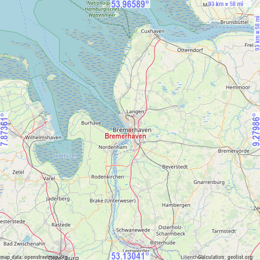
| Upper-left | 53.96589°, | 7.87361° |
| Center: | 53.55021°, | 8.57673° |
| Lower-right: | 53.13041°, | 9.27986° |
| Map W x H: | 92.9×92.9 km | = 57.7×57.7mi |
| max Lat: | 55.01917° ⇑13.8% North |
| Bremerhaven: | 53.55021° |
| min Lat: | ⇓86.2% South 47.40724° |
| min Long | Bremerhaven | max Long |
| 5.92978° | 8.57673° | 14.98853° |
| W 29.6%⇐ | ⇒70.4% E |
Elevation
Elevation of Bremerhaven is 5 m = 16 ft, and this is 244.1 m = 801 ft below average elevation for this country.
| Max E: |
1256 m = 4121 ft | 96.6% |
| Avg. | 249.1 m = 817 ft | |
| Bremerhaven | 5 m = 16 ft | |
Min E: |
-5 m = -16 ft | 3.4% |
See also: Bremerhaven elevation on elevation.city.
Geographical zone
Bremerhaven is located in North temperate zone (between Tropic of Cancer and the Arctic Circle). Distance of this North polar circle is 1446.9 km =899.1 mi to North.| Distance of | km | miles | from Bremerhaven |
|---|---|---|---|
| North Pole | 4052.8 | 2518.3 | to North |
| Arctic Circle | 1446.9 | 899.1 | to North |
| Tropic Cancer | 3348.3 | 2080.5 | to South |
| Equator | 5954.2 | 3699.8 | to South |


Nearby cities:
15 places around Bremerhaven: (largest is in red/bold)
• Butjadingen
16 km =9.9 mi,  268°
268°
• Dorum
15.3 km =9.5 mi,  357°
357°
• Drangstedt
13.8 km =8.6 mi,  59°
59°
• Elmlohe
11.7 km =7.3 mi,  69°
69°
• Heerstedt
15.3 km =9.5 mi,  128°
128°
• Hollen
16.3 km =10.1 mi,  148°
148°
• Kührstedt
15.1 km =9.4 mi,  78°
78°
• Langen
6.3 km =3.9 mi,  11°
11°
• Loxstedt
10.5 km =6.5 mi, 152°
• Misselwarden
14.5 km =9 mi,  344°
344°
• Mulsum
13.1 km =8.1 mi,  352°
352°
• Nordenham
9.5 km =5.9 mi,  221°
221°
• Schiffdorf
5.2 km =3.2 mi,  111°
111°
• Stinstedt
12.2 km =7.6 mi, 134°
• Wremen
11.8 km =7.3 mi, 340°
Sources, notices
• [Note1] Compared only with cities in Germany existing in our database
• [Src1] Map data: © OpenStreetMap contributors (CC-BY-SA)
• [Src2] Other city data from geonames.org with taken over terms of usage.
• [Src3] Geographical zone / Annual Mean Temperature by Robert A. Rohde @ Wikipedia
