Dähre geodata
Dähre (Saxony-Anhalt) is a seat of a fourth-order administrative division; located in Germany in Europe/Berlin (GMT+2) time zone. With population of 917 people, there are 7466 cities with bigger population in this country. Compared to other cities in Germany, 80.4% of cities are located further ↓South; 65.6% of cities are located further ←West and 80.2% of cities have higher elevation than Dähre. Note1


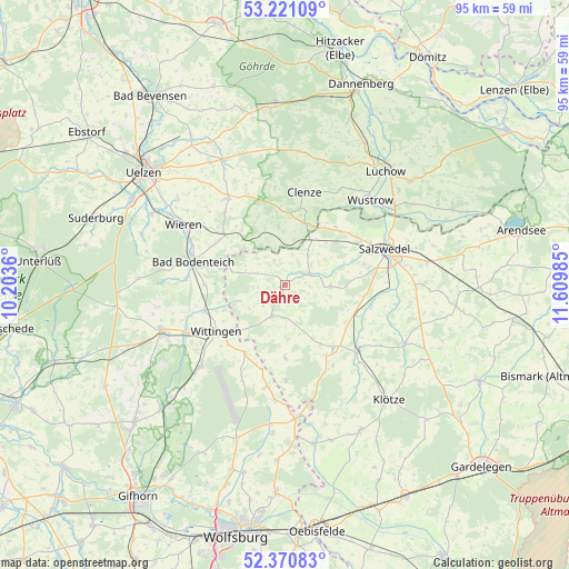
Dähre GPS coordinates[2]
52° 47' 52.944" North, 10° 54' 24.192" East
| Map corner | latitude | longitude |
|---|---|---|
| Upper-left | 53.22109°, | 10.2036° |
| Center: | 52.79804°, | 10.90672° |
| Lower-right: | 52.37083°, | 11.60985° |
| Map W x H: | 94.5×94.5 km | = 58.7×58.7mi |
| max Lat: | 55.01917° ⇑19.6% North |
| Dähre: | 52.79804° |
| min Lat: | ⇓80.4% South 47.40724° |
| min Long | Dähre | max Long |
| 5.92978° | 10.90672° | 14.98853° |
| W 65.6%⇐ | ⇒34.4% E |
Elevation
Elevation of Dähre is 46 m = 151 ft, and this is 203.1 m = 666 ft below average elevation for this country.
| Max E: |
1256 m = 4121 ft | 80.2% |
| Avg. | 249.1 m = 817 ft | |
| Dähre | 46 m = 151 ft | |
Min E: |
-5 m = -16 ft | 19.8% |
See also: Germany elevation on elevation.city.
Geographical zone
Dähre is located in North temperate zone (between Tropic of Cancer and the Arctic Circle). Distance of this North polar circle is 1530.6 km =951.1 mi to North.| Distance of | km | miles | from Dähre |
|---|---|---|---|
| North Pole | 4136.5 | 2570.3 | to North |
| Arctic Circle | 1530.6 | 951.1 | to North |
| Tropic Cancer | 3264.7 | 2028.6 | to South |
| Equator | 5870.6 | 3647.8 | to South |


Nearby cities:
15 places around Dähre: (largest is in red/bold)
• Beetzendorf
16.2 km =10.1 mi,  130°
130°
• Bergen an der Dumme
10.9 km =6.8 mi,  17°
17°
• Bodenteich
15.5 km =9.6 mi,  283°
283°
• Clenze
15.9 km =9.9 mi,  12°
12°
• Henningen
6.3 km =3.9 mi,  37°
37°
• Jübar
12.1 km =7.5 mi,  179°
179°
• Kuhfelde
14.2 km =8.8 mi,  96°
96°
• Luckau
17.3 km =10.7 mi,  33°
33°
• Lüder
16.2 km =10.1 mi,  274°
274°
• Osterwohle
8 km =5 mi,  57°
57°
• Rohrberg
13.5 km =8.4 mi,  138°
138°
• Schnega
10.4 km =6.5 mi,  354°
354°
• Soltendieck
12.9 km =8 mi,  310°
310°
• Wallstawe
7.4 km =4.6 mi,  88°
88°
• Wittingen
13.9 km =8.6 mi,  235°
235°
Sources, notices
• [Note1] Compared only with cities in Germany existing in our database
• [Src1] Map data: © OpenStreetMap contributors (CC-BY-SA)
• [Src2] Other city data from geonames.org with taken over terms of usage.
• [Src3] Geographical zone / Annual Mean Temperature by Robert A. Rohde @ Wikipedia
