Henningen geodata
Henningen (Saxony-Anhalt) is a populated place; located in Germany in Europe/Berlin (GMT+2) time zone. With population of 671 people, there are 8470 cities with bigger population in this country. Compared to other cities in Germany, 80.7% of cities are located further ↓South; 66.4% of cities are located further ←West and 83.2% of cities have higher elevation than Henningen. Note1
Administrative division(s):
- Level 1: Saxony-Anhalt
- Level 3: Altmarkkreis Salzwedel
- Level 4: Salzwedel


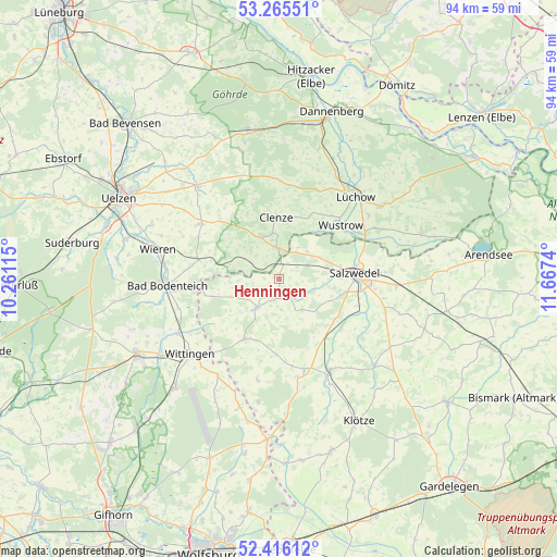
Henningen GPS coordinates[2]
52° 50' 34.404" North, 10° 57' 51.372" East
| Map corner | latitude | longitude |
|---|---|---|
| Upper-left | 53.26551°, | 10.26115° |
| Center: | 52.84289°, | 10.96427° |
| Lower-right: | 52.41612°, | 11.6674° |
| Map W x H: | 94.4×94.4 km | = 58.7×58.7mi |
| max Lat: | 55.01917° ⇑19.3% North |
| Henningen: | 52.84289° |
| min Lat: | ⇓80.7% South 47.40724° |
| min Long | Henningen | max Long |
| 5.92978° | 10.96427° | 14.98853° |
| W 66.4%⇐ | ⇒33.6% E |
Elevation
Elevation of Henningen is 39 m = 128 ft, and this is 210.1 m = 689 ft below average elevation for this country.
| Max E: |
1256 m = 4121 ft | 83.2% |
| Avg. | 249.1 m = 817 ft | |
| Henningen | 39 m = 128 ft | |
Min E: |
-5 m = -16 ft | 16.8% |
See also: Germany elevation on elevation.city.
Geographical zone
Henningen is located in North temperate zone (between Tropic of Cancer and the Arctic Circle). Distance of this North polar circle is 1525.6 km =948 mi to North.| Distance of | km | miles | from Henningen |
|---|---|---|---|
| North Pole | 4131.5 | 2567.2 | to North |
| Arctic Circle | 1525.6 | 948 | to North |
| Tropic Cancer | 3269.7 | 2031.7 | to South |
| Equator | 5875.6 | 3650.9 | to South |


Nearby cities:
15 places around Henningen: (largest is in red/bold)
• Bergen an der Dumme
5.4 km =3.4 mi,  354°
354°
• Clenze
10.5 km =6.5 mi,  357°
357°
• Dähre
6.3 km =3.9 mi,  217°
217°
• Kuhfelde
12.2 km =7.6 mi,  122°
122°
• Küsten
16.4 km =10.2 mi,  23°
23°
• Luckau
11 km =6.8 mi,  31°
31°
• Lübbow
16.4 km =10.2 mi,  62°
62°
• Osterwohle
3 km =1.9 mi,  103°
103°
• Rohrberg
15.9 km =9.9 mi,  161°
161°
• Salzwedel
12.7 km =7.9 mi,  84°
84°
• Schnega
7.2 km =4.5 mi,  318°
318°
• Soltendieck
14 km =8.7 mi,  284°
284°
• Suhlendorf
16.6 km =10.3 mi,  307°
307°
• Wallstawe
5.9 km =3.7 mi,  143°
143°
• Wustrow
14.2 km =8.8 mi,  50°
50°
Sources, notices
• [Note1] Compared only with cities in Germany existing in our database
• [Src1] Map data: © OpenStreetMap contributors (CC-BY-SA)
• [Src2] Other city data from geonames.org with taken over terms of usage.
• [Src3] Geographical zone / Annual Mean Temperature by Robert A. Rohde @ Wikipedia
