Königsmark geodata
Königsmark (Saxony-Anhalt) is a populated place; located in Germany in Europe/Berlin (GMT+2) time zone. With population of 530 people, there are 9193 cities with bigger population in this country. Compared to other cities in Germany, 80.4% of cities are located further ↓South; 79.4% of cities are located further ←West and 89.3% of cities have higher elevation than Königsmark. Note1
Administrative division(s):
- Level 1: Saxony-Anhalt
- Level 3: Landkreis Stendal
- Level 4: Osterburg (Altmark)


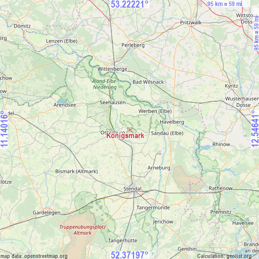
Königsmark GPS coordinates[2]
52° 47' 57.012" North, 11° 50' 35.808" East
| Map corner | latitude | longitude |
|---|---|---|
| Upper-left | 53.22221°, | 11.14016° |
| Center: | 52.79917°, | 11.84328° |
| Lower-right: | 52.37197°, | 12.54641° |
| Map W x H: | 94.5×94.5 km | = 58.7×58.7mi |
| max Lat: | 55.01917° ⇑19.6% North |
| Königsmark: | 52.79917° |
| min Lat: | ⇓80.4% South 47.40724° |
| min Long | Königsmark | max Long |
| 5.92978° | 11.84328° | 14.98853° |
| W 79.4%⇐ | ⇒20.6% E |
Elevation
Elevation of Königsmark is 23 m = 75 ft, and this is 226.1 m = 742 ft below average elevation for this country.
| Max E: |
1256 m = 4121 ft | 89.3% |
| Avg. | 249.1 m = 817 ft | |
| Königsmark | 23 m = 75 ft | |
Min E: |
-5 m = -16 ft | 10.7% |
See also: Germany elevation on elevation.city.
Geographical zone
Königsmark is located in North temperate zone (between Tropic of Cancer and the Arctic Circle). Distance of this North polar circle is 1530.5 km =951 mi to North.| Distance of | km | miles | from Königsmark |
|---|---|---|---|
| North Pole | 4136.3 | 2570.2 | to North |
| Arctic Circle | 1530.5 | 951 | to North |
| Tropic Cancer | 3264.8 | 2028.7 | to South |
| Equator | 5870.7 | 3647.9 | to South |


Nearby cities:
15 places around Königsmark: (largest is in red/bold)
• Behrendorf
8.4 km =5.2 mi,  68°
68°
• Bretsch
15.1 km =9.4 mi,  287°
287°
• Erxleben
7.5 km =4.7 mi,  223°
223°
• Flessau
12.4 km =7.7 mi,  249°
249°
• Goldbeck
9.2 km =5.7 mi,  172°
172°
• Hohenberg-Krusemark
10.8 km =6.7 mi,  139°
139°
• Iden
5.2 km =3.2 mi,  114°
114°
• Krevese
10.2 km =6.3 mi,  278°
278°
• Osterburg
6.2 km =3.9 mi,  257°
257°
• Rochau
12.2 km =7.6 mi,  212°
212°
• Rühstädt
13.2 km =8.2 mi,  6°
6°
• Sandau
13.7 km =8.5 mi,  94°
94°
• Schönberg
9.1 km =5.7 mi,  352°
352°
• Seehausen
11.7 km =7.3 mi,  328°
328°
• Werben
11.6 km =7.2 mi,  53°
53°
Sources, notices
• [Note1] Compared only with cities in Germany existing in our database
• [Src1] Map data: © OpenStreetMap contributors (CC-BY-SA)
• [Src2] Other city data from geonames.org with taken over terms of usage.
• [Src3] Geographical zone / Annual Mean Temperature by Robert A. Rohde @ Wikipedia
