Hohenberg-Krusemark geodata
Hohenberg-Krusemark (Saxony-Anhalt) is a seat of a fourth-order administrative division; located in Germany in Europe/Berlin (GMT+2) time zone. With population of 669 people, there are 8479 cities with bigger population in this country. Compared to other cities in Germany, 79.9% of cities are located further ↓South; 81% of cities are located further ←West and 86.6% of cities have higher elevation than Hohenberg-Krusemark. Note1
Administrative division(s):
- Level 1: Saxony-Anhalt
- Level 3: Landkreis Stendal
- Level 4: Hohenberg-Krusemark


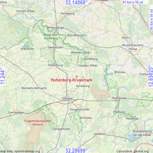
Hohenberg-Krusemark GPS coordinates[2]
52° 43' 29.676" North, 11° 56' 49.632" East
| Map corner | latitude | longitude |
|---|---|---|
| Upper-left | 53.14868°, | 11.244° |
| Center: | 52.72491°, | 11.94712° |
| Lower-right: | 52.29699°, | 12.65025° |
| Map W x H: | 94.7×94.7 km | = 58.8×58.8mi |
| max Lat: | 55.01917° ⇑20.1% North |
| Hohenberg-Krusemark: | 52.72491° |
| min Lat: | ⇓79.9% South 47.40724° |
| min Long | Hohenberg-Kruse | max Long |
| 5.92978° | 11.94712° | 14.98853° |
| W 81%⇐ | ⇒19% E |
Elevation
Elevation of Hohenberg-Krusemark is 31 m = 102 ft, and this is 218.1 m = 716 ft below average elevation for this country.
| Max E: |
1256 m = 4121 ft | 86.6% |
| Avg. | 249.1 m = 817 ft | |
| Hohenberg-Krusemark | 31 m = 102 ft | |
Min E: |
-5 m = -16 ft | 13.4% |
See also: Germany elevation on elevation.city.
Geographical zone
Hohenberg-Krusemark is located in North temperate zone (between Tropic of Cancer and the Arctic Circle). Distance of this North polar circle is 1538.7 km =956.1 mi to North.| Distance of | km | miles | from Hohenberg-Krusemark |
|---|---|---|---|
| North Pole | 4144.6 | 2575.3 | to North |
| Arctic Circle | 1538.7 | 956.1 | to North |
| Tropic Cancer | 3256.5 | 2023.5 | to South |
| Equator | 5862.5 | 3642.8 | to South |


Nearby cities:
15 places around Hohenberg-Krusemark: (largest is in red/bold)
• Arneburg
6.7 km =4.2 mi,  144°
144°
• Behrendorf
11.3 km =7 mi,  4°
4°
• Erxleben
12.5 km =7.8 mi,  283°
283°
• Goldbeck
5.9 km =3.7 mi,  261°
261°
• Hassel
9.6 km =6 mi,  188°
188°
• Havelberg
14.6 km =9.1 mi,  36°
36°
• Iden
6.5 km =4 mi,  339°
339°
• Jarchau
8.5 km =5.3 mi,  204°
204°
• Kamern
11.4 km =7.1 mi,  76°
76°
• Klietz
10.3 km =6.4 mi,  127°
127°
• Königsmark
10.8 km =6.7 mi,  319°
319°
• Osterburg
14.8 km =9.2 mi,  297°
297°
• Rochau
13.8 km =8.6 mi, 261°
• Sandau
9.8 km =6.1 mi, 42°
• Stendal
14.4 km =8.9 mi, 204°
Sources, notices
• [Note1] Compared only with cities in Germany existing in our database
• [Src1] Map data: © OpenStreetMap contributors (CC-BY-SA)
• [Src2] Other city data from geonames.org with taken over terms of usage.
• [Src3] Geographical zone / Annual Mean Temperature by Robert A. Rohde @ Wikipedia
