Kneitlingen geodata
Kneitlingen (Lower Saxony) is a seat of a fourth-order administrative division; located in Germany in Europe/Berlin (GMT+2) time zone. With population of 851 people, there are 7697 cities with bigger population in this country. Compared to other cities in Germany, 73.8% of cities are located further ↓South; 63.4% of cities are located further ←West and 57.8% of cities have higher elevation than Kneitlingen. Note1
Administrative division(s):
- Level 1: Lower Saxony
- Level 3: Landkreis Wolfenbüttel
- Level 4: Kneitlingen


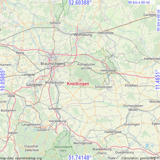
Kneitlingen GPS coordinates[2]
52° 10' 29.172" North, 10° 45' 43.092" East
| Map corner | latitude | longitude |
|---|---|---|
| Upper-left | 52.60388°, | 10.05885° |
| Center: | 52.17477°, | 10.76197° |
| Lower-right: | 51.74148°, | 11.4651° |
| Map W x H: | 95.9×95.9 km | = 59.6×59.6mi |
| max Lat: | 55.01917° ⇑26.2% North |
| Kneitlingen: | 52.17477° |
| min Lat: | ⇓73.8% South 47.40724° |
| min Long | Kneitlingen | max Long |
| 5.92978° | 10.76197° | 14.98853° |
| W 63.4%⇐ | ⇒36.6% E |
Elevation
Elevation of Kneitlingen is 169 m = 554 ft, and this is 80.1 m = 263 ft below average elevation for this country.
| Max E: |
1256 m = 4121 ft | 57.8% |
| Avg. | 249.1 m = 817 ft | |
| Kneitlingen | 169 m = 554 ft | |
Min E: |
-5 m = -16 ft | 42.2% |
See also: Germany elevation on elevation.city.
Geographical zone
Kneitlingen is located in North temperate zone (between Tropic of Cancer and the Arctic Circle). Distance of this North polar circle is 1599.9 km =994.1 mi to North.| Distance of | km | miles | from Kneitlingen |
|---|---|---|---|
| North Pole | 4205.8 | 2613.4 | to North |
| Arctic Circle | 1599.9 | 994.1 | to North |
| Tropic Cancer | 3195.4 | 1985.5 | to South |
| Equator | 5801.3 | 3604.8 | to South |


Nearby cities:
15 places around Kneitlingen: (largest is in red/bold)
• Dahlum
7.6 km =4.7 mi,  127°
127°
• Destedt
7.9 km =4.9 mi,  333°
333°
• Dettum
6.4 km =4 mi,  267°
267°
• Erkerode
4.9 km =3 mi,  313°
313°
• Evessen
3.8 km =2.4 mi,  294°
294°
• Königslutter am Elm
9.3 km =5.8 mi,  23°
23°
• Remlingen
9.1 km =5.7 mi,  221°
221°
• Räbke
8.3 km =5.2 mi,  73°
73°
• Schöppenstedt
3.6 km =2.2 mi,  166°
166°
• Semmenstedt
10 km =6.2 mi,  206°
206°
• Sickte
9.5 km =5.9 mi,  300°
300°
• Uehrde
8.4 km =5.2 mi,  178°
178°
• Vahlberg
5.5 km =3.4 mi, 213°
• Veltheim
7.3 km =4.5 mi, 312°
• Wittmar
9.7 km =6 mi,  238°
238°
Sources, notices
• [Note1] Compared only with cities in Germany existing in our database
• [Src1] Map data: © OpenStreetMap contributors (CC-BY-SA)
• [Src2] Other city data from geonames.org with taken over terms of usage.
• [Src3] Geographical zone / Annual Mean Temperature by Robert A. Rohde @ Wikipedia
