Schöppenstedt geodata
Schöppenstedt (Lower Saxony) is a populated place; located in Germany in Europe/Berlin (GMT+2) time zone. With population of 5,961 people, there are 2471 cities with bigger population in this country. Compared to other cities in Germany, 73.5% of cities are located further ↓South; 63.6% of cities are located further ←West and 66.9% of cities have higher elevation than Schöppenstedt. Note1
Administrative division(s):
- Level 1: Lower Saxony
- Level 3: Landkreis Wolfenbüttel
- Level 4: Schöppenstedt


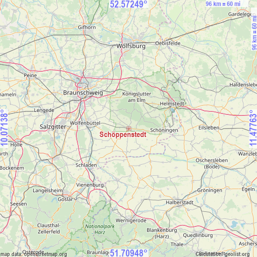
Schöppenstedt GPS coordinates[2]
52° 8' 35.088" North, 10° 46' 28.2" East
| Map corner | latitude | longitude |
|---|---|---|
| Upper-left | 52.57249°, | 10.07138° |
| Center: | 52.14308°, | 10.7745° |
| Lower-right: | 51.70948°, | 11.47763° |
| Map W x H: | 96×96 km | = 59.7×59.7mi |
| max Lat: | 55.01917° ⇑26.5% North |
| Schöppenstedt: | 52.14308° |
| min Lat: | ⇓73.5% South 47.40724° |
| min Long | Schöppenstedt | max Long |
| 5.92978° | 10.7745° | 14.98853° |
| W 63.6%⇐ | ⇒36.4% E |
Elevation
Elevation of Schöppenstedt is 109 m = 358 ft, and this is 140.1 m = 460 ft below average elevation for this country.
| Max E: |
1256 m = 4121 ft | 66.9% |
| Avg. | 249.1 m = 817 ft | |
| Schöppenstedt | 109 m = 358 ft | |
Min E: |
-5 m = -16 ft | 33.1% |
See also: Germany elevation on elevation.city.
Geographical zone
Schöppenstedt is located in North temperate zone (between Tropic of Cancer and the Arctic Circle). Distance of this North polar circle is 1603.4 km =996.3 mi to North.| Distance of | km | miles | from Schöppenstedt |
|---|---|---|---|
| North Pole | 4209.3 | 2615.5 | to North |
| Arctic Circle | 1603.4 | 996.3 | to North |
| Tropic Cancer | 3191.8 | 1983.3 | to South |
| Equator | 5797.8 | 3602.6 | to South |


Nearby cities:
15 places around Schöppenstedt: (largest is in red/bold)
• Dahlum
5.3 km =3.3 mi,  101°
101°
• Dettum
8 km =5 mi,  294°
294°
• Erkerode
8.2 km =5.1 mi,  327°
327°
• Evessen
6.7 km =4.2 mi,  319°
319°
• Gevensleben
8.1 km =5 mi,  156°
156°
• Ingeleben
7.9 km =4.9 mi,  120°
120°
• Kneitlingen
3.6 km =2.2 mi,  346°
346°
• Remlingen
7.6 km =4.7 mi,  244°
244°
• Roklum
8.8 km =5.5 mi,  195°
195°
• Räbke
9.2 km =5.7 mi,  50°
50°
• Semmenstedt
7.6 km =4.7 mi,  224°
224°
• Uehrde
4.9 km =3 mi,  187°
187°
• Vahlberg
4.1 km =2.5 mi,  254°
254°
• Winnigstedt
8.5 km =5.3 mi,  182°
182°
• Wittmar
9.3 km =5.8 mi,  260°
260°
Sources, notices
• [Note1] Compared only with cities in Germany existing in our database
• [Src1] Map data: © OpenStreetMap contributors (CC-BY-SA)
• [Src2] Other city data from geonames.org with taken over terms of usage.
• [Src3] Geographical zone / Annual Mean Temperature by Robert A. Rohde @ Wikipedia
