Kleinpaschleben geodata
Kleinpaschleben (Saxony-Anhalt) is a populated place; located in Germany in Europe/Berlin (GMT+2) time zone. With population of 986 people, there are 7236 cities with bigger population in this country. Compared to other cities in Germany, 69.8% of cities are located further ↓South; 80% of cities are located further ←West and 72.6% of cities have higher elevation than Kleinpaschleben. Note1
Administrative division(s):
- Level 1: Saxony-Anhalt
- Level 3: Anhalt-Bitterfeld
- Level 4: Osternienburger Land


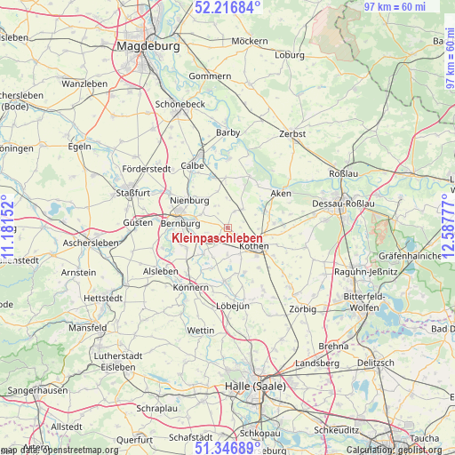
Kleinpaschleben GPS coordinates[2]
51° 47' 2.256" North, 11° 53' 4.704" East
| Map corner | latitude | longitude |
|---|---|---|
| Upper-left | 52.21684°, | 11.18152° |
| Center: | 51.78396°, | 11.88464° |
| Lower-right: | 51.34689°, | 12.58777° |
| Map W x H: | 96.7×96.7 km | = 60.1×60.1mi |
| max Lat: | 55.01917° ⇑30.2% North |
| Kleinpaschleben: | 51.78396° |
| min Lat: | ⇓69.8% South 47.40724° |
| min Long | Kleinpaschleben | max Long |
| 5.92978° | 11.88464° | 14.98853° |
| W 80%⇐ | ⇒20% E |
Elevation
Elevation of Kleinpaschleben is 74 m = 243 ft, and this is 175.1 m = 574 ft below average elevation for this country.
| Max E: |
1256 m = 4121 ft | 72.6% |
| Avg. | 249.1 m = 817 ft | |
| Kleinpaschleben | 74 m = 243 ft | |
Min E: |
-5 m = -16 ft | 27.4% |
See also: Germany elevation on elevation.city.
Geographical zone
Kleinpaschleben is located in North temperate zone (between Tropic of Cancer and the Arctic Circle). Distance of this North polar circle is 1643.3 km =1021.1 mi to North.| Distance of | km | miles | from Kleinpaschleben |
|---|---|---|---|
| North Pole | 4249.2 | 2640.3 | to North |
| Arctic Circle | 1643.3 | 1021.1 | to North |
| Tropic Cancer | 3151.9 | 1958.5 | to South |
| Equator | 5757.8 | 3577.7 | to South |


Nearby cities:
15 places around Kleinpaschleben: (largest is in red/bold)
• Baalberge
6.3 km =3.9 mi,  250°
250°
• Biendorf
4.5 km =2.8 mi,  213°
213°
• Cörmigk
7 km =4.3 mi, 205°
• Drosa
3.9 km =2.4 mi,  22°
22°
• Gerbitz
7.6 km =4.7 mi,  327°
327°
• Großpaschleben
4.2 km =2.6 mi,  127°
127°
• Köthen
6.9 km =4.3 mi,  121°
121°
• Latdorf
6.4 km =4 mi,  295°
295°
• Micheln
6.6 km =4.1 mi,  65°
65°
• Osternienburger Land
9.3 km =5.8 mi,  78°
78°
• Poley
4.5 km =2.8 mi,  257°
257°
• Preußlitz
7.6 km =4.7 mi,  221°
221°
• Wohlsdorf
2.5 km =1.6 mi, 211°
• Wulfen
5.1 km =3.2 mi,  38°
38°
• Zabitz
2.7 km =1.7 mi,  87°
87°
Sources, notices
• [Note1] Compared only with cities in Germany existing in our database
• [Src1] Map data: © OpenStreetMap contributors (CC-BY-SA)
• [Src2] Other city data from geonames.org with taken over terms of usage.
• [Src3] Geographical zone / Annual Mean Temperature by Robert A. Rohde @ Wikipedia
