Kirchheim geodata
Kirchheim (Hesse) is a seat of a fourth-order administrative division; located in Germany in Europe/Berlin (GMT+2) time zone. With population of 3,913 people, there are 3346 cities with bigger population in this country. Compared to other cities in Germany, 54.8% of cities are located further ↓South; 56.8% of cities are located further →East and 52.9% of cities have lower elevation than Kirchheim. Note1
Administrative division(s):
- Level 1: Hesse
- Level 2: Regierungsbezirk Kassel
- Level 3: Landkreis Hersfeld-Rotenburg
- Level 4: Kirchheim


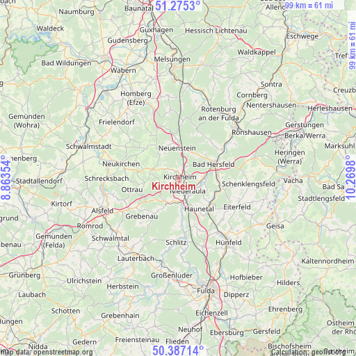
Kirchheim GPS coordinates[2]
50° 49' 59.988" North, 9° 34' 0.012" East
| Map corner | latitude | longitude |
|---|---|---|
| Upper-left | 51.2753°, | 8.86354° |
| Center: | 50.83333°, | 9.56667° |
| Lower-right: | 50.38714°, | 10.2698° |
| Map W x H: | 98.8×98.8 km | = 61.4×61.4mi |
| max Lat: | 55.01917° ⇑45.2% North |
| Kirchheim: | 50.83333° |
| min Lat: | ⇓54.8% South 47.40724° |
| min Long | Kirchheim | max Long |
| 5.92978° | 9.56667° | 14.98853° |
| W 43.2%⇐ | ⇒56.8% E |
Elevation
Elevation of Kirchheim is 246 m = 807 ft, and this is 3.1 m = 10 ft below average elevation for this country.
| Max E: |
1256 m = 4121 ft | 47.1% |
| Avg. | 249.1 m = 817 ft | |
| Kirchheim | 246 m = 807 ft | |
Min E: |
-5 m = -16 ft | 52.9% |
See also: Germany elevation on elevation.city.
Geographical zone
Kirchheim is located in North temperate zone (between Tropic of Cancer and the Arctic Circle). Distance of this North polar circle is 1749 km =1086.8 mi to North.| Distance of | km | miles | from Kirchheim |
|---|---|---|---|
| North Pole | 4354.9 | 2706 | to North |
| Arctic Circle | 1749 | 1086.8 | to North |
| Tropic Cancer | 3046.2 | 1892.8 | to South |
| Equator | 5652.1 | 3512.1 | to South |


Nearby cities:
15 places around Kirchheim: (largest is in red/bold)
• Bad Hersfeld
10.9 km =6.8 mi,  66°
66°
• Breitenbach
20.4 km =12.7 mi,  47°
47°
• Burghaun
18.8 km =11.7 mi,  143°
143°
• Eiterfeld
18 km =11.2 mi,  114°
114°
• Grebenau
12.1 km =7.5 mi,  213°
213°
• Neukirchen
16 km =9.9 mi,  284°
284°
• Niederaula
4.4 km =2.7 mi,  147°
147°
• Oberaula
7.3 km =4.5 mi, 284°
• Ottrau
13.1 km =8.1 mi,  256°
256°
• Riebelsdorf
18.8 km =11.7 mi,  285°
285°
• Schenklengsfeld
20 km =12.4 mi,  95°
95°
• Schlitz
17.7 km =11 mi,  181°
181°
• Schrecksbach
19.9 km =12.4 mi,  270°
270°
• Schwarzenborn
12 km =7.5 mi,  315°
315°
• Seigertshausen
17 km =10.6 mi,  300°
300°
Sources, notices
• [Note1] Compared only with cities in Germany existing in our database
• [Src1] Map data: © OpenStreetMap contributors (CC-BY-SA)
• [Src2] Other city data from geonames.org with taken over terms of usage.
• [Src3] Geographical zone / Annual Mean Temperature by Robert A. Rohde @ Wikipedia
