Oberaula geodata
Oberaula (Hesse) is a seat of a fourth-order administrative division; located in Germany in Europe/Berlin (GMT+2) time zone. With population of 3,481 people, there are 3626 cities with bigger population in this country. Compared to other cities in Germany, 55% of cities are located further ↓South; 58.4% of cities are located further →East and 66.7% of cities have lower elevation than Oberaula. Note1
Administrative division(s):
- Level 1: Hesse
- Level 2: Regierungsbezirk Kassel
- Level 3: Schwalm-Eder-Kreis
- Level 4: Oberaula


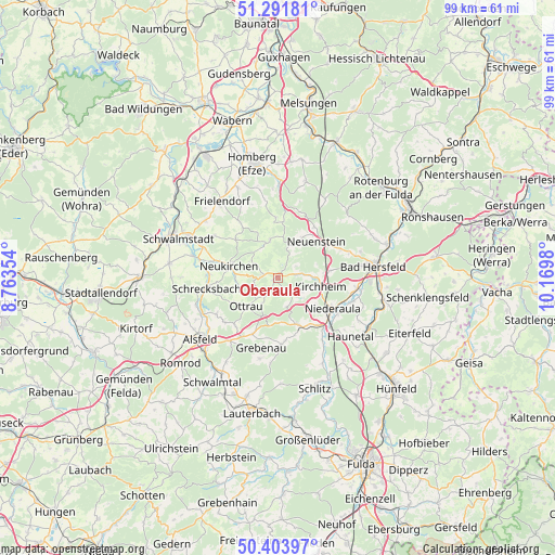
Oberaula GPS coordinates[2]
50° 51' 0" North, 9° 28' 0.012" East
| Map corner | latitude | longitude |
|---|---|---|
| Upper-left | 51.29181°, | 8.76354° |
| Center: | 50.85°, | 9.46667° |
| Lower-right: | 50.40397°, | 10.1698° |
| Map W x H: | 98.7×98.7 km | = 61.3×61.3mi |
| max Lat: | 55.01917° ⇑45% North |
| Oberaula: | 50.85° |
| min Lat: | ⇓55% South 47.40724° |
| min Long | Oberaula | max Long |
| 5.92978° | 9.46667° | 14.98853° |
| W 41.6%⇐ | ⇒58.4% E |
Elevation
Elevation of Oberaula is 333 m = 1093 ft, and this is 83.9 m = 275 ft above average elevation for this country.
| Max E: |
1256 m = 4121 ft | 33.3% |
| Oberaula | 333 m 1093 ft | |
| Avg. | 249.1 m = 817 ft | |
Min E: |
-5 m = -16 ft | 66.7% |
See also: Germany elevation on elevation.city.
Geographical zone
Oberaula is located in North temperate zone (between Tropic of Cancer and the Arctic Circle). Distance of this North polar circle is 1747.2 km =1085.7 mi to North.| Distance of | km | miles | from Oberaula |
|---|---|---|---|
| North Pole | 4353.1 | 2704.9 | to North |
| Arctic Circle | 1747.2 | 1085.7 | to North |
| Tropic Cancer | 3048.1 | 1894 | to South |
| Equator | 5654 | 3513.2 | to South |


Nearby cities:
15 places around Oberaula: (largest is in red/bold)
• Alsfeld
17.6 km =10.9 mi,  231°
231°
• Bad Hersfeld
17.2 km =10.7 mi,  81°
81°
• Frielendorf
16.8 km =10.4 mi,  323°
323°
• Grebenau
12 km =7.5 mi,  177°
177°
• Homberg
20.5 km =12.7 mi,  347°
347°
• Kirchheim
7.3 km =4.5 mi,  104°
104°
• Neukirchen
8.7 km =5.4 mi,  284°
284°
• Niederaula
10.9 km =6.8 mi,  120°
120°
• Ottrau
7.5 km =4.7 mi, 229°
• Riebelsdorf
11.6 km =7.2 mi,  285°
285°
• Schrecksbach
13 km =8.1 mi,  261°
261°
• Schwalmstadt
19.8 km =12.3 mi,  297°
297°
• Schwarzenborn
6.8 km =4.2 mi, 348°
• Seigertshausen
10.2 km =6.3 mi,  311°
311°
• Willingshausen
18.7 km =11.6 mi,  270°
270°
Sources, notices
• [Note1] Compared only with cities in Germany existing in our database
• [Src1] Map data: © OpenStreetMap contributors (CC-BY-SA)
• [Src2] Other city data from geonames.org with taken over terms of usage.
• [Src3] Geographical zone / Annual Mean Temperature by Robert A. Rohde @ Wikipedia
