Breitbrunn geodata
Breitbrunn (Bavaria) is a populated place; located in Germany in Europe/Berlin (GMT+2) time zone. With population of 1,423 people, there are 6034 cities with bigger population in this country. Compared to other cities in Germany, 95% of cities are located further ↑North; 83.9% of cities are located further ←West and 85.3% of cities have lower elevation than Breitbrunn. Note1
Administrative division(s):
- Level 1: Bavaria
- Level 2: Upper Bavaria
- Level 3: Landkreis Rosenheim
- Level 4: Edling


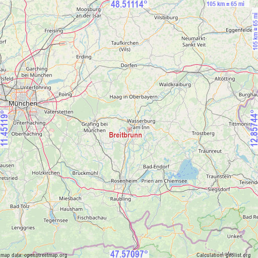
Breitbrunn GPS coordinates[2]
48° 2' 35.52" North, 12° 9' 15.516" East
| Map corner | latitude | longitude |
|---|---|---|
| Upper-left | 48.51114°, | 11.45119° |
| Center: | 48.0432°, | 12.15431° |
| Lower-right: | 47.57097°, | 12.85744° |
| Map W x H: | 104.5×104.5 km | = 64.9×64.9mi |
| max Lat: | 55.01917° ⇑95% North |
| Breitbrunn: | 48.0432° |
| min Lat: | ⇓5% South 47.40724° |
| min Long | Breitbrunn | max Long |
| 5.92978° | 12.15431° | 14.98853° |
| W 83.9%⇐ | ⇒16.1% E |
Elevation
Elevation of Breitbrunn is 472 m = 1549 ft, and this is 222.9 m = 731 ft above average elevation for this country.
| Max E: |
1256 m = 4121 ft | 14.7% |
| Breitbrunn | 472 m 1549 ft | |
| Avg. | 249.1 m = 817 ft | |
Min E: |
-5 m = -16 ft | 85.3% |
See also: Germany elevation on elevation.city.
Geographical zone
Breitbrunn is located in North temperate zone (between Tropic of Cancer and the Arctic Circle). Distance of this North polar circle is 2059.3 km =1279.6 mi to North.| Distance of | km | miles | from Breitbrunn |
|---|---|---|---|
| North Pole | 4665.2 | 2898.8 | to North |
| Arctic Circle | 2059.3 | 1279.6 | to North |
| Tropic Cancer | 2736 | 1700.1 | to South |
| Equator | 5341.9 | 3319.3 | to South |


Nearby cities:
15 places around Breitbrunn: (largest is in red/bold)
• Albaching
8.1 km =5 mi,  336°
336°
• Babensham
9.5 km =5.9 mi,  61°
61°
• Edling
1.6 km =1 mi,  28°
28°
• Eiselfing
6.6 km =4.1 mi,  91°
91°
• Emmering
8.9 km =5.5 mi,  235°
235°
• Eschenlohe
9.7 km =6 mi,  252°
252°
• Fraueneuharting
7.9 km =4.9 mi,  266°
266°
• Griesstätt
5.7 km =3.5 mi,  162°
162°
• Pfaffing
3.6 km =2.2 mi,  290°
290°
• Ramerberg
2.9 km =1.8 mi,  193°
193°
• Rechtmehring
8.2 km =5.1 mi,  6°
6°
• Schonstett
9.7 km =6 mi,  133°
133°
• Schönberg
9.9 km =6.2 mi,  79°
79°
• Soyen
8.3 km =5.2 mi, 29°
• Wasserburg am Inn
5.2 km =3.2 mi, 78°
Sources, notices
• [Note1] Compared only with cities in Germany existing in our database
• [Src1] Map data: © OpenStreetMap contributors (CC-BY-SA)
• [Src2] Other city data from geonames.org with taken over terms of usage.
• [Src3] Geographical zone / Annual Mean Temperature by Robert A. Rohde @ Wikipedia
