Ramerberg geodata
Ramerberg (Bavaria) is a seat of a fourth-order administrative division; located in Germany in Europe/Berlin (GMT+2) time zone. With population of 1,346 people, there are 6190 cities with bigger population in this country. Compared to other cities in Germany, 95.3% of cities are located further ↑North; 83.8% of cities are located further ←West and 85.9% of cities have lower elevation than Ramerberg. Note1
Administrative division(s):
- Level 1: Bavaria
- Level 2: Upper Bavaria
- Level 3: Landkreis Rosenheim
- Level 4: Ramerberg


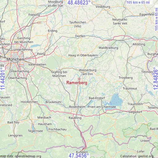
Ramerberg GPS coordinates[2]
48° 1' 5.016" North, 12° 8' 42.468" East
| Map corner | latitude | longitude |
|---|---|---|
| Upper-left | 48.48623°, | 11.44201° |
| Center: | 48.01806°, | 12.14513° |
| Lower-right: | 47.5456°, | 12.84826° |
| Map W x H: | 104.6×104.6 km | = 65×65mi |
| max Lat: | 55.01917° ⇑95.3% North |
| Ramerberg: | 48.01806° |
| min Lat: | ⇓4.7% South 47.40724° |
| min Long | Ramerberg | max Long |
| 5.92978° | 12.14513° | 14.98853° |
| W 83.8%⇐ | ⇒16.2% E |
Elevation
Elevation of Ramerberg is 477 m = 1565 ft, and this is 227.9 m = 748 ft above average elevation for this country.
| Max E: |
1256 m = 4121 ft | 14.1% |
| Ramerberg | 477 m 1565 ft | |
| Avg. | 249.1 m = 817 ft | |
Min E: |
-5 m = -16 ft | 85.9% |
See also: Germany elevation on elevation.city.
Geographical zone
Ramerberg is located in North temperate zone (between Tropic of Cancer and the Arctic Circle). Distance of this North polar circle is 2062.1 km =1281.3 mi to North.| Distance of | km | miles | from Ramerberg |
|---|---|---|---|
| North Pole | 4668 | 2900.6 | to North |
| Arctic Circle | 2062.1 | 1281.3 | to North |
| Tropic Cancer | 2733.2 | 1698.3 | to South |
| Equator | 5339.1 | 3317.6 | to South |


Nearby cities:
15 places around Ramerberg: (largest is in red/bold)
• Albaching
10.5 km =6.5 mi,  345°
345°
• Aßling
10.7 km =6.6 mi,  254°
254°
• Breitbrunn
2.9 km =1.8 mi,  13°
13°
• Edling
4.5 km =2.8 mi,  18°
18°
• Eiselfing
7.7 km =4.8 mi,  70°
70°
• Emmering
7 km =4.3 mi, 250°
• Eschenlohe
8.6 km =5.3 mi,  269°
269°
• Fraueneuharting
7.6 km =4.7 mi,  287°
287°
• Griesstätt
3.6 km =2.2 mi,  138°
138°
• Pfaffing
4.9 km =3 mi,  326°
326°
• Rechtmehring
11.1 km =6.9 mi, 8°
• Schechen
10 km =6.2 mi,  189°
189°
• Schonstett
8.7 km =5.4 mi,  116°
116°
• Vogtareuth
8.4 km =5.2 mi,  161°
161°
• Wasserburg am Inn
7 km =4.3 mi,  56°
56°
Sources, notices
• [Note1] Compared only with cities in Germany existing in our database
• [Src1] Map data: © OpenStreetMap contributors (CC-BY-SA)
• [Src2] Other city data from geonames.org with taken over terms of usage.
• [Src3] Geographical zone / Annual Mean Temperature by Robert A. Rohde @ Wikipedia
