Kirchdorf geodata
Kirchdorf (Mecklenburg-Vorpommern) is a populated place; located in Germany in Europe/Berlin (GMT+2) time zone. With population of 578 people, there are 8931 cities with bigger population in this country. Compared to other cities in Germany, 94.8% of cities are located further ↓South; 94.2% of cities are located further ←West and 92.3% of cities have higher elevation than Kirchdorf. Note1
Administrative division(s):
- Level 1: Mecklenburg-Vorpommern
- Level 3: Vorpommern-Rügen
- Level 4: Sundhagen


Kirchdorf GPS coordinates[2]
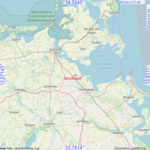
54° 10' 30" North, 13° 16' 28.452" East
| Map corner | latitude | longitude |
|---|---|---|
| Upper-left | 54.5845°, | 12.57145° |
| Center: | 54.175°, | 13.27457° |
| Lower-right: | 53.7614°, | 13.9777° |
| Map W x H: | 91.5×91.5 km | = 56.9×56.9mi |
| max Lat: | 55.01917° ⇑5.2% North |
| Kirchdorf: | 54.175° |
| min Lat: | ⇓94.8% South 47.40724° |
| min Long | Kirchdorf | max Long |
| 5.92978° | 13.27457° | 14.98853° |
| W 94.2%⇐ | ⇒5.8% E |
Elevation
Elevation of Kirchdorf is 15 m = 49 ft, and this is 234.1 m = 768 ft below average elevation for this country.
| Max E: |
1256 m = 4121 ft | 92.3% |
| Avg. | 249.1 m = 817 ft | |
| Kirchdorf | 15 m = 49 ft | |
Min E: |
-5 m = -16 ft | 7.7% |
See also: Germany elevation on elevation.city.
Geographical zone
Kirchdorf is located in North temperate zone (between Tropic of Cancer and the Arctic Circle). Distance of this North polar circle is 1377.5 km =855.9 mi to North.| Distance of | km | miles | from Kirchdorf |
|---|---|---|---|
| North Pole | 3983.4 | 2475.2 | to North |
| Arctic Circle | 1377.5 | 855.9 | to North |
| Tropic Cancer | 3417.8 | 2123.7 | to South |
| Equator | 6023.7 | 3743 | to South |


Nearby cities:
15 places around Kirchdorf: (largest is in red/bold)
• Brandshagen
9.9 km =6.2 mi,  316°
316°
• Dersekow
14.4 km =8.9 mi,  175°
175°
• Elmenhorst
13.7 km =8.5 mi,  288°
288°
• Garz
16.7 km =10.4 mi,  17°
17°
• Greifswald
11.7 km =7.3 mi,  140°
140°
• Grimmen
16.8 km =10.4 mi,  245°
245°
• Hinrichshagen Hof
12.3 km =7.6 mi,  156°
156°
• Mesekenhagen
4.1 km =2.5 mi, 135°
• Poseritz
13.7 km =8.5 mi,  0°
0°
• Sassen
17.7 km =11 mi,  198°
198°
• Stoltenhagen
12.9 km =8 mi,  261°
261°
• Weitenhagen
16.1 km =10 mi,  146°
146°
• Wendorf
15.7 km =9.8 mi,  304°
304°
• Wittenhagen
13.3 km =8.3 mi,  274°
274°
• Zarrendorf
13.2 km =8.2 mi, 301°
Sources, notices
• [Note1] Compared only with cities in Germany existing in our database
• [Src1] Map data: © OpenStreetMap contributors (CC-BY-SA)
• [Src2] Other city data from geonames.org with taken over terms of usage.
• [Src3] Geographical zone / Annual Mean Temperature by Robert A. Rohde @ Wikipedia
