Kemnitz geodata
Kemnitz (Mecklenburg-Vorpommern) is a populated place; located in Germany in Europe/Berlin (GMT+2) time zone. With population of 1,253 people, there are 6430 cities with bigger population in this country. Compared to other cities in Germany, 93.6% of cities are located further ↓South; 96% of cities are located further ←West and 97% of cities have higher elevation than Kemnitz. Note1
Administrative division(s):
- Level 1: Mecklenburg-Vorpommern
- Level 3: Vorpommern-Greifswald
- Level 4: Kemnitz


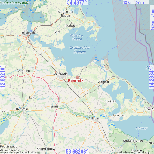
Kemnitz GPS coordinates[2]
54° 4' 38.028" North, 13° 32' 7.008" East
| Map corner | latitude | longitude |
|---|---|---|
| Upper-left | 54.4877°, | 12.83216° |
| Center: | 54.07723°, | 13.53528° |
| Lower-right: | 53.66266°, | 14.23841° |
| Map W x H: | 91.7×91.7 km | = 57×57mi |
| max Lat: | 55.01917° ⇑6.4% North |
| Kemnitz: | 54.07723° |
| min Lat: | ⇓93.6% South 47.40724° |
| min Long | Kemnitz | max Long |
| 5.92978° | 13.53528° | 14.98853° |
| W 96%⇐ | ⇒4% E |
Elevation
Elevation of Kemnitz is 4 m = 13 ft, and this is 245.1 m = 804 ft below average elevation for this country.
| Max E: |
1256 m = 4121 ft | 97% |
| Avg. | 249.1 m = 817 ft | |
| Kemnitz | 4 m = 13 ft | |
Min E: |
-5 m = -16 ft | 3% |
See also: Germany elevation on elevation.city.
Geographical zone
Kemnitz is located in North temperate zone (between Tropic of Cancer and the Arctic Circle). Distance of this North polar circle is 1388.3 km =862.6 mi to North.| Distance of | km | miles | from Kemnitz |
|---|---|---|---|
| North Pole | 3994.2 | 2481.9 | to North |
| Arctic Circle | 1388.3 | 862.6 | to North |
| Tropic Cancer | 3406.9 | 2116.9 | to South |
| Equator | 6012.8 | 3736.2 | to South |


Nearby cities:
15 places around Kemnitz: (largest is in red/bold)
• Behrenhoff
12.4 km =7.7 mi,  229°
229°
• Brünzow
3.6 km =2.2 mi,  32°
32°
• Greifswald
9.8 km =6.1 mi,  280°
280°
• Groß Kiesow
8.1 km =5 mi,  207°
207°
• Hanshagen
3.6 km =2.2 mi,  171°
171°
• Hinrichshagen Hof
12 km =7.5 mi,  268°
268°
• Hohendorf
13.8 km =8.6 mi,  112°
112°
• Katzow
9.9 km =6.2 mi, 109°
• Loissin
3.9 km =2.4 mi,  353°
353°
• Lubmin
8.3 km =5.2 mi,  39°
39°
• Lühmannsdorf
10 km =6.2 mi,  139°
139°
• Neu Boltenhagen
5 km =3.1 mi,  103°
103°
• Weitenhagen
8.6 km =5.3 mi,  252°
252°
• Wusterhusen
6.6 km =4.1 mi,  52°
52°
• Züssow
11.2 km =7 mi,  175°
175°
Sources, notices
• [Note1] Compared only with cities in Germany existing in our database
• [Src1] Map data: © OpenStreetMap contributors (CC-BY-SA)
• [Src2] Other city data from geonames.org with taken over terms of usage.
• [Src3] Geographical zone / Annual Mean Temperature by Robert A. Rohde @ Wikipedia
