Weißenthurm geodata
Weißenthurm (Rheinland-Pfalz) is a populated place; located in Germany in Europe/Berlin (GMT+2) time zone. With population of 7,639 people, there are 2031 cities with bigger population in this country. Compared to other cities in Germany, 54.2% of cities are located further ↑North; 87.8% of cities are located further →East and 71.8% of cities have higher elevation than Weißenthurm. Note1
Administrative division(s):
- Level 1: Rheinland-Pfalz
- Level 3: Landkreis Mayen-Koblenz
- Level 4: Weißenthurm


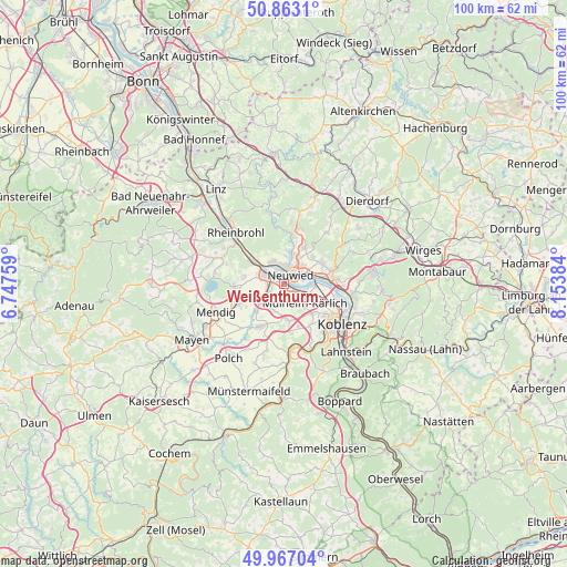
Weißenthurm GPS coordinates[2]
50° 25' 1.884" North, 7° 27' 2.592" East
| Map corner | latitude | longitude |
|---|---|---|
| Upper-left | 50.8631°, | 6.74759° |
| Center: | 50.41719°, | 7.45072° |
| Lower-right: | 49.96704°, | 8.15384° |
| Map W x H: | 99.6×99.6 km | = 61.9×61.9mi |
| max Lat: | 55.01917° ⇑54.2% North |
| Weißenthurm: | 50.41719° |
| min Lat: | ⇓45.8% South 47.40724° |
| min Long | Weißenthurm | max Long |
| 5.92978° | 7.45072° | 14.98853° |
| W 12.2%⇐ | ⇒87.8% E |
Elevation
Elevation of Weißenthurm is 79 m = 259 ft, and this is 170.1 m = 558 ft below average elevation for this country.
| Max E: |
1256 m = 4121 ft | 71.8% |
| Avg. | 249.1 m = 817 ft | |
| Weißenthurm | 79 m = 259 ft | |
Min E: |
-5 m = -16 ft | 28.2% |
See also: Germany elevation on elevation.city.
Geographical zone
Weißenthurm is located in North temperate zone (between Tropic of Cancer and the Arctic Circle). Distance of this North polar circle is 1795.3 km =1115.5 mi to North.| Distance of | km | miles | from Weißenthurm |
|---|---|---|---|
| North Pole | 4401.2 | 2734.8 | to North |
| Arctic Circle | 1795.3 | 1115.5 | to North |
| Tropic Cancer | 2999.9 | 1864.1 | to South |
| Equator | 5605.9 | 3483.3 | to South |


Nearby cities:
15 places around Weißenthurm: (largest is in red/bold)
• Andernach
3.6 km =2.2 mi,  295°
295°
• Bassenheim
6.6 km =4.1 mi,  174°
174°
• Heimbach
6.9 km =4.3 mi,  58°
58°
• Kaltenengers
7 km =4.3 mi,  90°
90°
• Kettig
2.2 km =1.4 mi,  149°
149°
• Kretz
6.7 km =4.2 mi,  249°
249°
• Leutesdorf
6 km =3.7 mi,  307°
307°
• Melsbach
7.7 km =4.8 mi,  17°
17°
• Mülheim-Kärlich
4.9 km =3 mi,  136°
136°
• Neuwied
2.3 km =1.4 mi,  37°
37°
• Nickenich
8.8 km =5.5 mi,  267°
267°
• Plaidt
4.9 km =3 mi,  236°
236°
• Saffig
4.5 km =2.8 mi,  212°
212°
• Sankt Sebastian
7.9 km =4.9 mi,  95°
95°
• Urmitz
4.7 km =2.9 mi, 90°
Sources, notices
• [Note1] Compared only with cities in Germany existing in our database
• [Src1] Map data: © OpenStreetMap contributors (CC-BY-SA)
• [Src2] Other city data from geonames.org with taken over terms of usage.
• [Src3] Geographical zone / Annual Mean Temperature by Robert A. Rohde @ Wikipedia
